Franchesse
| gmina | |
 | |
| Państwo | |
|---|---|
| Region | |
| Departament | |
| Okręg | |
| Kod INSEE | 03117 |
| Powierzchnia | 40,92 km² |
| Populacja (2015 I) • liczba ludności |
|
| • gęstość | 11,4 os./km² |
| Kod pocztowy | 03160 |
| Portal | |
Franchesse – miejscowość i gmina we Francji, w regionie Owernia-Rodan-Alpy, w departamencie Allier.
Demografia
Według danych na rok 1990 gminę zamieszkiwały 532 osoby, a gęstość zaludnienia wynosiła 13 osób/km². W styczniu 2015 r. Franchesse zamieszkiwało 466 osób, przy gęstości zaludnienia wynoszącej 11,4 osób/km².
Bibliografia
Media użyte na tej stronie
Autor: Superbenjamin, Licencja: CC BY-SA 4.0
Blank administrative map of France for geo-location purpose, with regions and departements distinguished. Approximate scale : 1:3,000,000
Autor: Flappiefh, Licencja: CC BY-SA 4.0
Carte administrative vierge de la région Auvergne-Rhône-Alpes, France, destinée à la géolocalisation.
Autor: Gérard JOYON, Licencja: CC BY 3.0
We see here, the back of the church. This Romanic work of engineering dates 12 and 13 ème centuries. Could have been built by the monks of SOUVIGNY, quite close village. The nave is three spans and collateral. The apse is of semicircular shape absidioles is circular. Classified as "Historic Monument" in 1886, this real marvel is abandoned. Inside the magnificent ceilings are attacked(affected) by the humidity, the saltpetre. By the earth(ground) full of water, (channels(canals) surrounding the village) ascents(rises) are made by the ground. Gérard JOYON
Autor: Flappiefh, Licencja: CC BY-SA 4.0
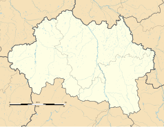
Blank administrative map of the department of Allier, France, for geo-location purpose.


