Frisco (Teksas)
| ||||
 Ratusz we Frisco. | ||||
| ||||
| Państwo | ||||
|---|---|---|---|---|
| Stan | ||||
| Hrabstwo | ||||
| Kod statystyczny | ||||
| Burmistrz | Jeff Cheney↗ | |||
| Powierzchnia | 179,2 km² | |||
| Wysokość | 236 m n.p.m. | |||
| Populacja (2020) • liczba ludności • gęstość |
| |||
| Nr kierunkowy | 972/469/214 | |||
| Kod pocztowy | 75033-75035 | |||
| Strefa czasowa | ||||
| Strona internetowa | ||||
| Portal | ||||
Frisco – miasto w Stanach Zjednoczonych, w stanie Teksas, w hrabstwach Collin i Denton. Jest częścią metropolii Dallas–Fort Worth. W 2018 roku magazyn Money uznał Frisco za miasto numer jeden na liście „50 najlepszych miejsc do życia w Ameryce”[1].
Demografia
W latach 2010–2020 populacja miasta wzrosła o 71,4% i tym samym Frisco było drugim najszybciej rozwijającym się miastem w USA, przekraczając w 2020 roku liczbę 200 tys. mieszkańców[2].
W latach 2010–2020 odnotowano ponad czterokrotny wzrost ludności azjatyckiej z 11 568 do 52 672 osób, co sprawia, że 26% mieszkańców miasta identyfikuje się jako Azjaci[3]. Większość Azjatów we Frisco to Hindusi, ale także Chińczycy, Koreańczycy i inni[4].
Przypisy
- ↑ Families are Moving to These 6 up-and-coming Cities in Texas, Pecan Square by Hillwood, 5 stycznia 2021 [dostęp 2022-01-19] (ang.).
- ↑ Clark Corbin, New 2020 Census data shows Meridian was one of the 10 fastest growing cities in the U.S., Idaho Capital Sun, 12 sierpnia 2021 [dostęp 2022-01-03] (ang.).
- ↑ Matt Payne, 2020 census: Frisco’s Asian community grows, impact, 4 listopada 2021 [dostęp 2022-01-03] (ang.).
- ↑ DP05 ACS DEMOGRAPHIC AND HOUSING ESTIMATES, data.census.gov [dostęp 2022-01-23].
Media użyte na tej stronie
Autor: Uwe Dedering, Licencja: CC BY-SA 3.0
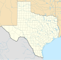
Location map of the USA (without Hawaii and Alaska).
EquiDistantConicProjection:
Central parallel:
* N: 37.0° N
Central meridian:
* E: 96.0° W
Standard parallels:
* 1: 32.0° N
* 2: 42.0° N
Made with Natural Earth. Free vector and raster map data @ naturalearthdata.com.
Formulas for x and y:
x = 50.0 + 124.03149777329222 * ((1.9694462586094064-({{{2}}}* pi / 180))
      * sin(0.6010514667026994 * ({{{3}}} + 96) * pi / 180))
y = 50.0 + 1.6155950752393982 * 124.03149777329222 * 0.02613325650382181
      - 1.6155950752393982  * 124.03149777329222 *
     (1.3236744353715044  - (1.9694462586094064-({{{2}}}* pi / 180))
      * cos(0.6010514667026994 * ({{{3}}} + 96) * pi / 180))
The flag of Navassa Island is simply the United States flag. It does not have a "local" flag or "unofficial" flag; it is an uninhabited island. The version with a profile view was based on Flags of the World and as a fictional design has no status warranting a place on any Wiki. It was made up by a random person with no connection to the island, it has never flown on the island, and it has never received any sort of recognition or validation by any authority. The person quoted on that page has no authority to bestow a flag, "unofficial" or otherwise, on the island.
Autor: Alexrk, Licencja: CC BY 3.0
Ta mapa została stworzona za pomocą GeoTools.
Flag of Frisco, Texas


