Góry Santa Monica
 Malibu Canyon w Górach Santa Monica | |
| Kontynent | |
|---|---|
| Państwo | |
| Najwyższy szczyt | Sandstone Peak |
| Długość | 40 km |
| Jednostka dominująca | Transverse Ranges |
| Sąsiednie pasma | Santa Susana, Simi Hills, Verdugo Mountains |
| 34°07′13″N 118°55′54″W/34,120300 -118,931800 | |
Góry Santa Monica – niewysokie pasmo górskie w Ameryce Północnej, na obszarze Stanów Zjednoczonych w Kalifornii położone równoleżnikowo nad Oceanem Spokojnym na północny zachód od Los Angeles. Długość pasma to ok. 40 km, najwyższy szczyt, Sandstone Peak, ma 948 m n.p.m.
Na południowym stoku wchodzącej w skład pasma góry Lee (500 m n.p.m.) znajduje się słynny znak Hollywood. Na terenie pasma znajduje się także ponad 20 stanowych i lokalnych parków. Atrakcją turystyczną jest również Paramount Ranch, na terenie którego kręcono m.in. serial Doktor Quinn.
Media użyte na tej stronie
Autor: Uwe Dedering, Licencja: CC BY-SA 3.0
Relief location map of the USA (without Hawaii and Alaska).
EquiDistantConicProjection : Central parallel :
* N: 37.0° N
Central meridian :
* E: 96.0° W
Standard parallels:
* 1: 32.0° N
* 2: 42.0° N
Made with Natural Earth. Free vector and raster map data @ naturalearthdata.com.
Formulas for x and y:
x = 50.0 + 124.03149777329222 * ((1.9694462586094064-({{{2}}}* pi / 180))
      * sin(0.6010514667026994 * ({{{3}}} + 96) * pi / 180))
y = 50.0 + 1.6155950752393982 * 124.03149777329222 * 0.02613325650382181
      - 1.6155950752393982  * 124.03149777329222 *
     (1.3236744353715044  - (1.9694462586094064-({{{2}}}* pi / 180))
      * cos(0.6010514667026994 * ({{{3}}} + 96) * pi / 180))
The flag of Navassa Island is simply the United States flag. It does not have a "local" flag or "unofficial" flag; it is an uninhabited island. The version with a profile view was based on Flags of the World and as a fictional design has no status warranting a place on any Wiki. It was made up by a random person with no connection to the island, it has never flown on the island, and it has never received any sort of recognition or validation by any authority. The person quoted on that page has no authority to bestow a flag, "unofficial" or otherwise, on the island.
Black up-pointing triangle ▲, U+25B2 from Unicode-Block Geometric Shapes (25A0–25FF)
Autor: Oryginalnym przesyłającym był Geographer z angielskiej Wikipedii, Licencja: CC BY 1.0
Malibu Canyon — looking north (upstream), in Malibu Creek State Park, Los Angeles County, California.
- Malibu Creek formed the canyon as it eroded through sedimentary layers as they were tilted upward to form the Santa Monica Mountains and thus it is older than the range itself. The Rindge Dam is visible at lower right, partly hidden by a Ceanothus bush. The dam was built by the owners of the Malibu Ranch (present day Malibu) in the early 20th century. It is now full of silt and serves no purpose while blocking the runs of endangered steelhead trout and is presently slated for removal.
- The common chaparral plants in the foreground are gray fine-leaved California sagebrush (Artemisia californica), and colorful Deerweed, (Lotus scoparius). This canyon burned in a brush fire in 1993, ten years prior to the photograph.
- Credits
Photographed and uploaded by user:Geographer.
- Taken April 26, 2003.
(c) Decumanus z angielskiej Wikipedii, CC-BY-SA-3.0
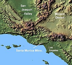
The western Transverse Ranges, with the Santa Monica Mountains indicated, in Southern California. ( © 2004 Matthew Trump )


