Gąsów (województwo opolskie)
| ||||
| ||||
| Państwo | ||||
| Województwo | opolskie | |||
| Miasto | Opole | |||
| SIMC | 0496780 | |||
| Strefa numeracyjna | 77 | |||
Położenie na mapie Polski (c) Karte: NordNordWest, Lizenz: Creative Commons by-sa-3.0 de | ||||
| Portal | ||||
Gąsów – część Opola, do 1 stycznia 2017 osada w Polsce położona w województwie opolskim, w powiecie opolskim, w gminie Komprachcice.
Zobacz też: Gąsów
Bibliografia
Media użyte na tej stronie
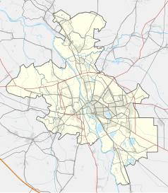
Opole location map.svg
Autor: SANtosito, Licencja: CC BY-SA 4.0
Location map of Opole, Opole Voivodeship, Poland. Geographic limits of the map:
Autor: SANtosito, Licencja: CC BY-SA 4.0
Location map of Opole, Opole Voivodeship, Poland. Geographic limits of the map:
- N: 50.78 N
- S: 50.58 N
- W: 17.78 E
- E: 18.05 E
Poland adm location map.svg
(c) Karte: NordNordWest, Lizenz: Creative Commons by-sa-3.0 de
Location map of Poland
(c) Karte: NordNordWest, Lizenz: Creative Commons by-sa-3.0 de
Location map of Poland
Opole Voivodeship location map.svg
Autor: Tymek1988, Licencja: CC BY-SA 4.0
Location map of Opole Voivodeship, Poland. Geographic limits of the map:
Autor: Tymek1988, Licencja: CC BY-SA 4.0
Location map of Opole Voivodeship, Poland. Geographic limits of the map:
- N: 51.2778 N
- S: 49.942 N
- W: 16.8461 E
- E: 18.8073 E


