Gadsden (Alabama)
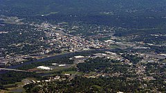
 Widok na Gadsden z lotu ptaka. | |
| Państwo | |
|---|---|
| Stan | |
| Hrabstwo | |
| Data założenia | 1840[1] |
| Prawa miejskie | 1871[1] |
| Burmistrz | Sherman Guyton |
| Powierzchnia | 100,1 km² |
| Wysokość | 165 m n.p.m. |
| Populacja (2020) • liczba ludności • gęstość |
|
| Nr kierunkowy | 256 |
| Kod pocztowy | 35901 |
| Strona internetowa | |
| Portal | |
Gadsden – miasto w Stanach Zjednoczonych, w północno-wschodniej części stanu Alabama, siedziba administracyjna hrabstwa Etowah, u podnóża Appalachów, nad rzeką Coosa (górny bieg rzeki Alabama). Według spisu w 2020 roku liczy 34 tys. mieszkańców, oraz 103,4 tys. w obszarze metropolitalnym[2].
W mieście rozwinął się przemysł chemiczny, odzieżowy, maszynowy oraz hutniczy[1].
Według danych z 2010 roku, Gadsden jest najbardziej ewangelikalnym miastem w USA, wśród aglomeracji liczących ponad 100 tys. mieszkańców – 61,6% populacji jest członkami kościołów ewangelikalnych, w większości baptystów[3]. Ponadto w mieście zauważalni są katolicy (7,3%), metodyści (5,5%), mormoni (0,8%), anglikanie (0,6%) i muzułmanie (0,6%)[4].
Przypisy
- ↑ a b c Gadsden, [w:] Encyklopedia PWN [online] [dostęp 2021-07-01].
- ↑ U.S. Census Bureau QuickFacts: Gadsden city, Alabama, www.census.gov [dostęp 2022-05-01] (ang.).
- ↑ Evangelical Protestant Metro Areas (2010) | QuickLists | The Association of Religion Data Archives, www.thearda.com [dostęp 2022-05-01].
- ↑ Gadsden, AL, Metropolitan Statistical Area - Religious Traditions, 2010, www.thearda.com [dostęp 2022-05-01].
Media użyte na tej stronie
Autor: Alexrk2, Licencja: CC BY 3.0
Ta mapa została stworzona za pomocą GeoTools.
Autor: Uwe Dedering, Licencja: CC BY-SA 3.0
Location map of the USA (without Hawaii and Alaska).
EquiDistantConicProjection:
Central parallel:
* N: 37.0° N
Central meridian:
* E: 96.0° W
Standard parallels:
* 1: 32.0° N
* 2: 42.0° N
Made with Natural Earth. Free vector and raster map data @ naturalearthdata.com.
Formulas for x and y:
x = 50.0 + 124.03149777329222 * ((1.9694462586094064-({{{2}}}* pi / 180))
      * sin(0.6010514667026994 * ({{{3}}} + 96) * pi / 180))
y = 50.0 + 1.6155950752393982 * 124.03149777329222 * 0.02613325650382181
      - 1.6155950752393982  * 124.03149777329222 *
     (1.3236744353715044  - (1.9694462586094064-({{{2}}}* pi / 180))
      * cos(0.6010514667026994 * ({{{3}}} + 96) * pi / 180))
The flag of Navassa Island is simply the United States flag. It does not have a "local" flag or "unofficial" flag; it is an uninhabited island. The version with a profile view was based on Flags of the World and as a fictional design has no status warranting a place on any Wiki. It was made up by a random person with no connection to the island, it has never flown on the island, and it has never received any sort of recognition or validation by any authority. The person quoted on that page has no authority to bestow a flag, "unofficial" or otherwise, on the island.
Autor: Curtis Palmer from Vestavia Hills (Birmingham), Alabama, USA, Licencja: CC BY 2.0
An aerial photo of Gadsden, Alabama, United States.


