Galeries Lafayette
 Galeries Lafayette nocą, z dekoracją bożonarodzeniową | |
| Państwo | |
|---|---|
| Region | |
| Miejscowość | |
| Typ budynku | |
| Styl architektoniczny | |
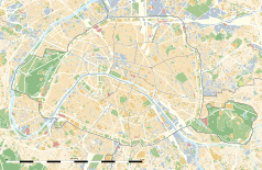
Położenie na mapie Paryża (c) Eric Gaba, Wikimedia Commons user Sting, CC BY-SA 3.0 | |
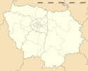
Położenie na mapie Île-de-France (c) Eric Gaba, Wikimedia Commons user Sting, CC BY-SA 3.0 | |
| Strona internetowa | |
Galeries Lafayette – dom handlowy położony w Paryżu.
Historia
W 1893 roku Théophile Bader oraz jego kuzyn, Alphonse Kahn otworzyli niewielką pasmanterię na rogu ulic La Fayette oraz de la Chaussée-d'Antin. W 1896 obaj kuzyni wykupili dom przy ulicy La Fayette pod numerem 1. W następnych latach kupili oni domy przy bulwarze Haussmanna pod numerem 38, 40 oraz 42 oraz pod numerem 15 przy ulicy de la Chaussée-d'Antin.
Bader połączył zakupione budynki pokrywając dachy wielką kopułą. Tak powstała jedna z najsłynniejszych paryskich galerii handlowych.
Obecnie Galeries Lafayette stanowi dziesięciopiętrową galerię handlową położona przy bulwarze Haussmanna w 9. dzielnicy Paryża.
W chwili obecnej Galeries Lafayette posiada swoje domy towarowe także w Berlinie oraz Nowym Jorku.
Dostęp do paryskiej galerii jest możliwy za pomocą paryskiego metra. Stacją najbliższą galerii jest Chaussée d'Antin – La Fayette.
Statystyki
- Liczba zatrudnionych: 12 063
- Liczba sklepów: 63
- Zysk netto: 1 621 700 euro
Linki zewnętrzne
Media użyte na tej stronie
(c) Eric Gaba, Wikimedia Commons user Sting, CC BY-SA 3.0
Blank land cover map of the city and department of Paris, France, as in January 2012, for geo-location purpose, with distinct boundaries for departments and arrondissements.
Autor: Superbenjamin, Licencja: CC BY-SA 4.0
Blank administrative map of France for geo-location purpose, with regions and departements distinguished. Approximate scale : 1:3,000,000
(c) Eric Gaba, Wikimedia Commons user Sting, CC BY-SA 3.0
Blank administrative map of the region of Île-de-France, France, as in January 2015, for geo-location purpose, with distinct boundaries for regions, departments and arrondissements.
Autor: Patricia.fidi, Licencja: CC0
Unofficial (de facto) flag of the region Île-de-France in France. It was also the flag of the kingdom of France (s.XIV-XV)
Autor: Jean-Noël Lafargue, Licencja: FAL
Galeries Lafayette department store, Christmas 2004, Paris, France.


