Gare d’Austerlitz
| ||
 | ||
| Państwo | ||
| Miejscowość | Paryż | |
| Data otwarcia | 1840 | |
| Dane techniczne | ||
| Liczba peronów | 7 | |
| Liczba krawędzi peronowych | 14 | |
| Kasy | ||
| Linie kolejowe | ||
| ||
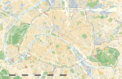
Położenie na mapie Paryża (c) Eric Gaba, Wikimedia Commons user Sting, CC BY-SA 3.0 | ||
| Portal | ||
Gare d’Austerlitz – jeden z głównych dworców kolejowych Paryża, stracił na znaczeniu po otwarciu LGV Atlantique. Posiada 21 torów. Także stacja metra.
|
Kontrola autorytatywna (stacja naziemna):
Media użyte na tej stronie
France location map-Regions and departements-2016.svg
Autor: Superbenjamin, Licencja: CC BY-SA 4.0
Blank administrative map of France for geo-location purpose, with regions and departements distinguished. Approximate scale : 1:3,000,000
Autor: Superbenjamin, Licencja: CC BY-SA 4.0
Blank administrative map of France for geo-location purpose, with regions and departements distinguished. Approximate scale : 1:3,000,000
Distinctive emblem for cultural property.svg
Blue Shield - the Distinctive emblem for the Protection of Cultural Property. The distinctive emblem is a protective symbol used during armed conflicts. Its use is restricted under international law.
Blue Shield - the Distinctive emblem for the Protection of Cultural Property. The distinctive emblem is a protective symbol used during armed conflicts. Its use is restricted under international law.
Tickmark icon.svg
Autor: MGalloway (WMF), Licencja: CC BY-SA 3.0
A tickmark icon included in the OOjs UI MediaWiki lib.
Autor: MGalloway (WMF), Licencja: CC BY-SA 3.0
A tickmark icon included in the OOjs UI MediaWiki lib.
Carte de l'Île de France (administrative).svg
Autor: Thibault Pelloquin, Licencja: CC BY-SA 3.0
Cette carte représente l'Île de France (en jaune pâle), ses limites départementales et régionales (en traits gris) et ses principaux cours et points d'eau (en bleu). Les départements limitrophes (sont en rose-orange pâle)
Autor: Thibault Pelloquin, Licencja: CC BY-SA 3.0
Cette carte représente l'Île de France (en jaune pâle), ses limites départementales et régionales (en traits gris) et ses principaux cours et points d'eau (en bleu). Les départements limitrophes (sont en rose-orange pâle)
Paris department land cover location map.svg
(c) Eric Gaba, Wikimedia Commons user Sting, CC BY-SA 3.0
Blank land cover map of the city and department of Paris, France, as in January 2012, for geo-location purpose, with distinct boundaries for departments and arrondissements.
(c) Eric Gaba, Wikimedia Commons user Sting, CC BY-SA 3.0
Blank land cover map of the city and department of Paris, France, as in January 2012, for geo-location purpose, with distinct boundaries for departments and arrondissements.
OOjs UI icon check.svg
Autor: MGalloway (WMF), Licencja: CC BY-SA 3.0
A tickmark icon included in the OOjs UI MediaWiki lib.
Autor: MGalloway (WMF), Licencja: CC BY-SA 3.0
A tickmark icon included in the OOjs UI MediaWiki lib.
Gare d'Austerlitz Paris FRA 001.jpg
Autor: ignis, Licencja: CC-BY-SA-3.0
Gare d'Austerlitz(Paris, France)
Autor: ignis, Licencja: CC-BY-SA-3.0
Gare d'Austerlitz(Paris, France)


