Gare de Villeneuve-Saint-Georges
| ||
 Budynek dworca | ||
| Państwo | ||
|---|---|---|
| Miejscowość | Villeneuve-Saint-Georges | |
| Zarządca | RFF / SNCF | |
| Data otwarcia | 1849 | |
| Dane techniczne | ||
| Liczba peronów | 4 | |
| Liczba krawędzi peronowych | 7 | |
| Kasy | ||
| Linie kolejowe | ||
| ||
| Portal | ||
Gare de Villeneuve-Saint-Georges – stacja kolejowa w Villeneuve-Saint-Georges, w departamencie Val-de-Marne, w regionie Île-de-France, we Francji.
Jest stacją Société nationale des chemins de fer français (SNCF), obsługiwaną przez pociągi RER linii D. Znajduje się na linii Paryż – Marsylia.
Linki zewnętrzne
| Villeneuve-Saint-Georges | ||
| Linia Paryż – Marsylia (14,386 km) | ||
odległość: 1,718 km | odległość: 3,064 km | |
| Linia Villeneuve-Saint-Georges – Montargis (14,386 km) | ||
odległość: 3,446 km | ||
Media użyte na tej stronie
Autor: Thibault Pelloquin, Licencja: CC BY-SA 3.0
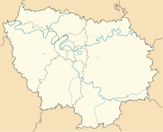
Cette carte représente l'Île de France (en jaune pâle), ses limites départementales et régionales (en traits gris) et ses principaux cours et points d'eau (en bleu). Les départements limitrophes (sont en rose-orange pâle)
Autor: Superbenjamin, Licencja: CC BY-SA 4.0
Blank administrative map of France for geo-location purpose, with regions and departements distinguished. Approximate scale : 1:3,000,000
Autor: MGalloway (WMF), Licencja: CC BY-SA 3.0
A tickmark icon included in the OOjs UI MediaWiki lib.
Autor: MGalloway (WMF), Licencja: CC BY-SA 3.0
A tickmark icon included in the OOjs UI MediaWiki lib.
head station, track to the left
head station, track to the left
Straight line aqross (according to naming convention, name + modifier)
station at track aqross
head station, track to the right
head station, track to the right
Autor: poudou99, Licencja: CC BY-SA 3.0
La Gare de Villeneuve-Saint-Georges, Villeneuve-Saint-Georges, département du Val-de-Marne, France


