Gauri Sankar
 Gauri Sankar po prawej. | |
| Państwo | |
|---|---|
| Położenie | |
| Pasmo | |
| Wysokość | 7134 m n.p.m. |
| Wybitność | 1570 m |
| Pierwsze wejście | 8 maja 1979 |
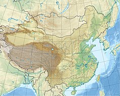
Gauri Sankar lub Gaurishankar (tyb.: Jomo Tseringma, chiń. 高里三喀峰 Gāolǐsānkā Fēng) – szczyt w Himalajach. Znajduje się na granicy między Chinami a Nepalem. Leży niedaleko Melungtse i ok. 100 km na północny wschód od Katmandu.
Pierwszego wejścia dokonali John Roskelley i Dorje Sherpa 8 maja 1979 r.
Bibliografia
Media użyte na tej stronie
Autor: Uwe Dedering, Licencja: CC BY-SA 3.0
Location map of China.
EquiDistantConicProjection : Central parallel :
* N: 36.0° N
Central meridian :
* E: 104.0° E
Standard parallels :
* 1: 30.0° N
* 2: 42.0° N
Latitudes on the central meridian :
* top: 57.0° N
* center: 37.29° N
* bottom: 17.96° N
Made with Natural Earth. Free vector and raster map data @ naturalearthdata.com.
Black up-pointing triangle ▲, U+25B2 from Unicode-Block Geometric Shapes (25A0–25FF)
Gauri Shankar in the foreground and Labuche Kang (Lapche Kang) in the background


