Geldermalsen
| |||||
 Stacja kolejowa Geldermalsen | |||||
| |||||
| Państwo | |||||
| Prowincja | |||||
| Burmistrz | Miranda de Vries (2014)[1] | ||||
| Powierzchnia | 101,73 km² | ||||
| Populacja (2014) • liczba ludności • gęstość | 26 339 [2] 263 os./km² | ||||
| Nr kierunkowy | 0345 | ||||
| Kod pocztowy | 4150-4153, 4155-4158, 4190-4191, 4194, 4196-4197 | ||||
| Strona internetowa | |||||
Geldermalsen – gmina w prowincji Geldria w Holandii. W 2014 roku populacja wyniosła 23 339 mieszkańców. Stolicą jest miejscowość o tej samej nazwie.
Przez gminę przechodzą autostrady A2 oraz A15, a także droga prowincjonalna N327.
Miejscowości
- Acquoy (610 mieszk.)
- Beesd (3500)
- Buurmalsen (1100)
- Deil (2140)
- Enspijk (565)
- Geldermalsen (10 600)
- Gellicum (300)
- Meteren (3755)
- Rhenoy (700)
- Rumpt (900)
- Tricht (2150)
Przypisy
- ↑ geldermalsen.nl: Mevrouw M.W.M. de Vries (niderl.). [dostęp 2014-07-09].
- ↑ Aktualna liczba mieszkańców miasta (nl) [dostęp 22 kwietnia 2014]
Media użyte na tej stronie
Flag of the Dutch municipality of Geldermalsen.
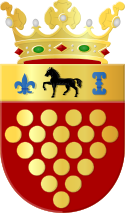
Coat of arms of Geldermalsen.
Autor: User:Markv, Licencja: CC-BY-SA-3.0
Station Geldermalsen aan de MerwedeLingelijn. Zicht op stationsgebouw en voorplein.
Autor: Erik Frohne, Licencja: CC BY-SA 3.0
Location map of province Gelderland in the Netherlands
Equirectangular projection, N/S stretching 163 %. Geographic limits of the map:
- N: 52.522° N
- S: 51.731° N
- W: 4.989° E
- E: 6.834° E


