Gmina Kohila
| Ten artykuł od 2018-02 wymaga zweryfikowania podanych informacji. |
| Gmina | |||||
 | |||||
| Państwo | |||||
|---|---|---|---|---|---|
| Prowincja | |||||
| Siedziba | |||||
| Powierzchnia | 230,2 km² | ||||
| Populacja (2007) • liczba ludności |
| ||||
| • gęstość | 29,25 os./km² | ||||
Położenie na mapie Estonii  (c) Karte: NordNordWest, Lizenz: Creative Commons by-sa-3.0 de | |||||
| 59°10′05″N 24°45′27″E/59,168056 24,757500 | |||||
| Strona internetowa | |||||
| Portal | |||||

Gmina Kohila (est. Kohila vald) – gmina wiejska w Estonii, w prowincji Rapla.
Skład gminy:
- Alev: Kohila.
- Alevik: Aespa, Hageri i Prillimäe.
- Wsie: Aandu, Adila, Angerja, Hageri, Kadaka, Lohu, Loone, Lümandu, Masti, Mälivere, Pahkla, Pihali, Pukamäe, Põikma, Rabivere, Rootsi, Salutaguse, Sutlema, Urge, Vana-Aespa, Vilivere.
Rabivere

Kohila

Tohisoo
Kohila

Hageri

Angerja
Lohu

Pahkla
| Alev | |
|---|---|
| Alevik |
|
| Wsie |
|


Media użyte na tej stronie
Estonia adm location map.svg
(c) Karte: NordNordWest, Lizenz: Creative Commons by-sa-3.0 de
Location map of Estonia
(c) Karte: NordNordWest, Lizenz: Creative Commons by-sa-3.0 de
Location map of Estonia


Kaselaug - Rabivere maastikukaitseala.jpg
Autor: Heino Ruiso, Licencja: CC BY-SA 3.0
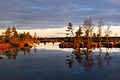
Morning in Rabivere Nature Park at Lake Kaselaug. Rapla County, Estonia.
Autor: Heino Ruiso, Licencja: CC BY-SA 3.0
Morning in Rabivere Nature Park at Lake Kaselaug. Rapla County, Estonia.

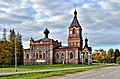
Kohila kirik2.jpg
Autor: Iifar, Licencja: CC BY-SA 3.0
Ta fotografia została wykonana za pomocą Nikon D3100.
Autor: Iifar, Licencja: CC BY-SA 3.0
Ta fotografia została wykonana za pomocą Nikon D3100.

Hageri kirik 2012.jpg
Autor: Ivar Leidus, Licencja: CC BY-SA 3.0 ee
This is a photo of cultural heritage monument of Estonia number
Autor: Ivar Leidus, Licencja: CC BY-SA 3.0 ee
This is a photo of cultural heritage monument of Estonia number

Eestimaa kivide kuningas ehk Pahkla Suurkivi.JPG
Autor: Kadri Niinsalu, Licencja: CC BY-SA 3.0
Pahkla, Raplamaa
Autor: Kadri Niinsalu, Licencja: CC BY-SA 3.0
Pahkla, Raplamaa


Kohila mõisa peahoone.jpg
Autor: Ivar Leidus, Licencja: CC BY-SA 3.0 ee
This is a photo of cultural heritage monument of Estonia number
Autor: Ivar Leidus, Licencja: CC BY-SA 3.0 ee
This is a photo of cultural heritage monument of Estonia number
Eesti kohila vald.png
Autor: Mmh, Licencja: CC BY-SA 3.0
Map of Estonia with borders of municipalities (parishes). Rapla county and Kohila municipality emphasized.
Autor: Mmh, Licencja: CC BY-SA 3.0
Map of Estonia with borders of municipalities (parishes). Rapla county and Kohila municipality emphasized.


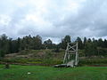
Angerja linnuse varemed.jpg
Autor: Kotkasulg, Licencja: CC BY-SA 3.0
Ruins of Angerja vassal castle in Estonia.
Autor: Kotkasulg, Licencja: CC BY-SA 3.0
Ruins of Angerja vassal castle in Estonia.