Gmina Muta
| Gmina | |||
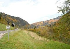
 Granica gminy Muta oraz gminy Podvelka | |||
| |||
| Państwo | |||
|---|---|---|---|
| Siedziba | Muta | ||
| Kod ISO 3166-2 | SI-081 | ||
| Żupan | Boris Kralj | ||
| Powierzchnia | 38,8 km²[1] | ||
| Populacja (2010) • liczba ludności | 3519[2] | ||
| • gęstość | 90,7 os./km² | ||
Położenie na mapie | |||
| Strona internetowa | |||
Muta – gmina w Słowenii. W 2002 roku liczyła 3640 mieszkańców.
Miejscowości
Miejscowości wchodzące w skład gminy Muta:
- Gortina,
- Mlake,
- Muta – siedziba gminy,
- Pernice,
- Sv. Jernej nad Muto,
- Sv. Primož nad Muto.
Przypisy
- ↑ „Statistični letopis Republike Slovenije”. XLIX (2010), s. 518-521, 2010. Vojka Vuk Dirnbek - redaktor. Lublana: Statistični urad Republike Slovenije. ISSN 1318-5403 (słoweń.).
- ↑ „Statistični letopis Republike Slovenije”. XLIX (2010), s. 522-524, 2010. Vojka Vuk Dirnbek - redaktor. Lublana: Statistični urad Republike Slovenije. ISSN 1318-5403 (słoweń.).
Media użyte na tej stronie
Coat of Arms of Slovenia.svg
The national coat of arms of Slovenia. Slovenias Coat of Arms defines three stars that represent the Counts of Celje, Triglav mountain and Adriatic sea.
The national coat of arms of Slovenia. Slovenias Coat of Arms defines three stars that represent the Counts of Celje, Triglav mountain and Adriatic sea.
Im Drautal westlich Brezno.jpg
Autor: Josef Moser, Licencja: CC BY-SA 3.0
Grenze der Gemeinden Muta/Mahrenberg und Podvelka/Podwölling im Drautal westlich Brezno/Fresen, Slowenien.
Autor: Josef Moser, Licencja: CC BY-SA 3.0
Grenze der Gemeinden Muta/Mahrenberg und Podvelka/Podwölling im Drautal westlich Brezno/Fresen, Slowenien.
Grb.Muta.png
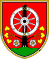
Wappen von Muta Slowenien
Wappen von Muta Slowenien


