Gmina Sztokholm
| gmina | |||
| |||
| Państwo | |||
|---|---|---|---|
| Region | |||
| Siedziba | |||
| Kod statystyczny | 0180 | ||
| Powierzchnia | 207,33 km² | ||
| Populacja (2014) • liczba ludności |
| ||
| • gęstość | 4872,78 os./km² | ||
Położenie na mapie regionu Sztokholm | |||
| Strona internetowa | |||
| Portal | |||
Gmina Sztokholm (nieformalnie miasto Sztokholm; szw. Stockholms kommun lub Stockholms stad)[1] – jedna z 290 gmin Szwecji. Siedzibą władz gminy (centralort) jest Sztokholm.
Geografia


Gmina Sztokholm jest położona w prowincjach historycznych (landskap) Uppland (część północna) i Södermanland (część południowa). W ujęciu statystycznym, według definicji Statistiska centralbyrån (SCB), większość zabudowy leży w obrębie tätortu Sztokholm. Na terenie gminy znajduje się także jeden småort – Geber, położony w granicach dzielnicy (stadsdel) Orhem. Sztokholm graniczy z gminami (w kolejności od kierunku północno-zachodniego):
- Järfälla
- Sollentuna
- Sundbyberg
- Solna
- Danderyd (przez Lilla Värtan)
- Lidingö (przez Lilla Värtan)
- Nacka
- Tyresö
- Huddinge
oraz od zachodu przez jezioro Melar z Ekerö.
Według definicji Statistiska centralbyrån (SCB) gmina zaliczana jest do obszaru metropolitalnego Sztokholmu (Stor-Stockholm; pol. „Wielki Sztokholm”)[2].
Powierzchnia
Gmina Sztokholm jest 252. pod względem powierzchni z 290 gmin Szwecji. Według danych pochodzących z 2015 r. całkowita powierzchnia gminy wynosi łącznie 207,33 km², z czego:
- 187,16 km² stanowi ląd
- 15,71 km² wody jeziora Melar
- 4,46 km² pozostałe wody śródlądowe.
Do gminy Sztokholm zalicza się także 7,27 km² obszaru morskiego[3].
Demografia
31 grudnia 2014 r. gmina Sztokholm liczyła 911 989 mieszkańców (1. pod względem zaludnienia z 290 gmin Szwecji)[4], gęstość zaludnienia wynosiła 4872,78 mieszkańców na km² lądu (2. pod względem gęstości zaludnienia z 290 gmin Szwecji).
Struktura demograficzna (31 grudnia 2014 )[5]:
| Opis | Ogółem | Kobiety | Mężczyźni | |||
|---|---|---|---|---|---|---|
| jednostka | osób | % | osób | % | osób | % |
| populacja | 911 989 | 100 | 462 729 | 50,74 | 449 260 | 49,26 |
| powierzchnia | 207,33 km² | |||||
| gęstość zaludnienia (mieszk./km²) | 4872,78 | |||||
Podział administracyjny Sztokholmu
Gmina Sztokholm (Stockholms kommun; pojęcie tożsame z miastem Sztokholm – Stockholms stad) podzielone jest na szereg jednostek terytorialnych, pełniących funkcję administracyjne lub statystyczne.
Niezależnie od istniejącego podziału administracyjnego, m.in. w celach statystycznych, używa się pojęć Inre staden (lub Innerstaden; pol. „Śródmieście”) oraz Yttre staden (lub Ytterstaden), który dzieli się na dwa tzw. stadsområde (pol. „obszar miasta”): Västerort oraz Söderort. Obszary te podzielone są na dzielnice (stadsdel). Innerstaden obejmuje 21 dzielnic, Västerort 44 dzielnice i Söderort 52 dzielnice.
Wszystkie 117 dzielnic (stadsdel), które nie pełnią obecnie żadnych funkcji administracyjnych, dzieli się na łącznie 408 tzw. basområde, używanych m.in. w statystyce ludności. Basområde stanowią jednostkę pośrednią pomiędzy dzielnicą (stadsdel), a najmniejszą jednostką – kwartałem miasta (kvarter), obejmującą zazwyczaj kilka sąsiadujących ze sobą nieruchomości (fastighet).
Dzielnice administracyjne (stadsdelsområde)
W wyniku reformy w 1997 r. utworzono 24 dzielnice administracyjne, nazwane stadsdelsområde i stanowiące pomocnicze jednostki administracyjne w ramach gminy Sztokholm. Grupują one po kilka mniejszych dzielnic (stadsdel) lub ich części i stanowią wobec nich jednostkę nadrzędną. W kolejnych latach ich liczba ulegała redukcji i od 1 stycznia 2007 r. gmina Sztokholm podzielona jest na 14 stadsdelsområde[6].
Każda dzielnica administracyjna (stadsdelsområde) zarządzana jest w ramach gminy Sztokholm przez radę dzielnicy (stadsdelsnämnd), w której zasiada 11 lub 13 stałych członków. Do zadań administracji poszczególnych dzielnic (stadsdelsförvaltning) należy obecnie m.in. nadzór nad przedszkolami i domami opieki, utrzymanie czystości w parkach, sprawy socjalne[7].
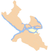
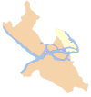
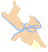
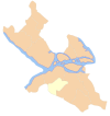
Dzielnice administracyjne (stadsdelsområde) Sztokholmu (31 grudnia 2014 r.)[8][9]:
| Dzielnica administracyjna (stadsdelsområde) | Liczba ludności | Powierzchnia (Obszar lądu w km²) | Gęstość zaludnienia (mk./km²) | Położenie |
|---|---|---|---|---|
| Södermalm | 126 736 | 8,00 | 15 842 |  |
| Enskede-Årsta-Vantör | 96 916 | 21,14 | 4584 |  |
| Hägersten-Liljeholmen | 83 283 | 13,08 | 6367 |  |
| Bromma | 74 161 | 24,60 | 3015 |  |
| Hässelby-Vällingby | 71 042 | 19,60 | 3625 |  |
| Östermalm | 70 779 | 18,00 | 3932 |  |
| Norrmalm | 69 592 | 4,92 | 14 148 |  |
| Kungsholmen | 68 016 | 4,85 | 14 024 |  |
| Farsta | 55 269 | 15,44 | 3580 |  |
| Rinkeby-Kista | 48 828 | 11,79 | 4141 |  |
| Skarpnäck | 45 340 | 15,50 | 2925 |  |
| Spånga-Tensta | 39 082 | 12,85 | 3041 |  |
| Skärholmen | 35 740 | 8,86 | 4034 |  |
| Älvsjö | 27 205 | 9,11 | 2986 |  |
| Sztokholm | 911 989 | 187,74 | 4858 |
Przypisy
- ↑ Sveriges Kommuner och Landsting: Stad, benämningen. [dostęp 2015-10-21]. (szw.).
- ↑ Statistiska centralbyrån: Storstadsområden med ingående kommuner i alfabetisk ordning. [dostęp 2015-10-21]. (szw.).
- ↑ Statistiska centralbyrån: Land- och vattenareal per den 1 januari efter region och arealtyp. År 2012 - 2018. [dostęp 2015-10-21]. (szw.).
- ↑ Statistiska centralbyrån: Folkmängd i riket, län och kommuner 31 december 2014 och befolkningsförändringar 1 oktober–31 december 2014. Totalt. [dostęp 2015-10-21]. (szw.).
- ↑ Statistiska centralbyrån: Folkmängd i riket, län och kommuner efter kön och ålder 31 december 2014. [dostęp 2015-10-21]. (szw.).
- ↑ Stockholms stad: Stadsdelsnämndernas historia. [dostęp 2015-10-21]. (szw.).
- ↑ Stockholms stad: Stadsdelförvaltningar. [dostęp 2015-10-21]. (szw.).
- ↑ Stockholms stad: Areal och befolkningstäthet i stadsdelsområden, SDN-delar och stadsdelar 2014-12-31. Stockholm. [dostęp 2015-10-21]. (szw.).
- ↑ Stockholms stad: Områdesfakta. [dostęp 2015-10-21]. (szw.).
Linki zewnętrzne
- Statistik om Stockholm. statistikomstockholm.se. [zarchiwizowane z tego adresu (2016-04-20)].
Media użyte na tej stronie
Autor: Holger.Ellgaard, Licencja: CC BY-SA 3.0
Stockholm från Kaknästornet
Autor: Alex Nordstrom, Jniemenmaa, Licencja: CC BY-SA 2.5
The borough (stadsdelsområde) of Rinkeby-Kista of the municipality of Stockholm, Sweden as of 2007.
Autor: Alex Nordstrom, Jniemenmaa, Licencja: CC BY-SA 2.5
The borough (stadsdelsområde) of Norrmalm of the municipality of Stockholm, Sweden as of 2007.
Autor: Alex Nordstrom, Jniemenmaa, Licencja: CC BY-SA 2.5
The borough (stadsdelsområde) of Hägersten-Liljeholmen of the municipality of Stockholm, Sweden as of 2007.
Autor: Arild Vågen, Licencja: CC BY-SA 3.0
Gamla stan (Old town), Stockholm.
Autor: Alex Nordstrom, Jniemenmaa, Licencja: CC BY-SA 2.5
The borough (stadsdelsområde) of Farsta of the municipality of Stockholm, Sweden as of 2007.
Autor: Alex Nordstrom, Jniemenmaa, Licencja: CC BY-SA 2.5
The borough (stadsdelsområde) of Kungsholmen of the municipality of Stockholm, Sweden as of 2007.
Autor: Kabelleger / David Gubler, Licencja: CC BY-SA 4.0
Storstockholms Lokaltrafik class C20 used on the Tunnelbana pictured near the Gamla Stan (old town) stop in Stockholm, Sweden.
Autor: Koyos, Licencja: CC BY-SA 2.5
This coat of arms was drawn based on its blazon which – being a written description – is free from copyright. Any illustration conforming with the blazon of the arms is considered to be heraldically correct. Thus several different artistic interpretations of the same coat of arms can exist. The design officially used by the armiger is likely protected by copyright, in which case it cannot be used here.
Individual representations of a coat of arms, drawn from a blazon, may have a copyright belonging to the artist, but are not necessarily derivative works.
Autor: Alex Nordstrom, Jniemenmaa, Licencja: CC BY-SA 2.5
The borough (stadsdelsområde) of Bromma of the municipality of Stockholm, Sweden as of 2007.
Autor: Autor nie został podany w rozpoznawalny automatycznie sposób. Założono, że to Nordelch (w oparciu o szablon praw autorskich)., Licencja: CC BY-SA 2.5
Stockholm Municipality in Stockholm County
- Designed by me.
- Mere outlines are a PD source from www.scb.se
Autor: Alex Nordstrom, Jniemenmaa, Licencja: CC BY-SA 2.5
The borough (stadsdelsområde) of Skarpnäck of the municipality of Stockholm, Sweden as of 2007.
Autor: Alex Nordstrom, Jniemenmaa, Licencja: CC BY-SA 2.5
The borough (stadsdelsområde) of Södermalm of the municipality of Stockholm, Sweden as of 2007.
Autor: Alex Nordstrom, Jniemenmaa, Licencja: CC BY-SA 2.5
The borough (stadsdelsområde) of Spånga-Tensta of the municipality of Stockholm, Sweden as of 2007.
Autor: Arild Vågen, Licencja: CC BY-SA 3.0
Stockholm City Hall
Autor: Holger.Ellgaard, Licencja: CC BY-SA 3.0
The Hjälmö city block (Farstavägen 87, 89 and 91) in Farsta, Stockholm, Sweden, three 17-story buildings built in 1961. Architects: Backström & Reinius.
Autor: Alex Nordstrom, Jniemenmaa, Licencja: CC BY-SA 2.5
The borough (stadsdelsområde) of Enskede-Årsta-Vantör of the municipality of Stockholm, Sweden as of 2007.
Autor: Lokal_Profil
, Licencja: CC BY-SA 2.5
This coat of arms was drawn based on its blazon which – being a written description – is free from copyright. Any illustration conforming with the blazon of the arms is considered to be heraldically correct. Thus several different artistic interpretations of the same coat of arms can exist. The design officially used by the armiger is likely protected by copyright, in which case it cannot be used here.
Individual representations of a coat of arms, drawn from a blazon, may have a copyright belonging to the artist, but are not necessarily derivative works.
Autor: Alex Nordstrom, Jniemenmaa, Licencja: CC BY-SA 2.5
The borough (stadsdelsområde) of Skärholmen of the municipality of Stockholm, Sweden as of 2007.
Autor: Alex Nordstrom, Jniemenmaa, Licencja: CC BY-SA 2.5
The borough (stadsdelsområde) of Hässelby-Vällingby of the municipality of Stockholm, Sweden as of 2007.
Autor: Alex Nordstrom, Jniemenmaa, Licencja: CC BY-SA 2.5
The borough (stadsdelsområde) of Östermalm of the municipality of Stockholm, Sweden as of 2007.
Autor: Alex Nordstrom, Jniemenmaa, Licencja: CC BY-SA 2.5
The borough (stadsdelsområde) of Älvsjö of the municipality of Stockholm, Sweden as of 2007.


