Gołdap Stadion
| Państwo | |
|---|---|
| Miejscowość | Gołdap |
| Poprzednie nazwy | Hermeshof (Ostpreußen) |
| Linie kolejowe | |
| |
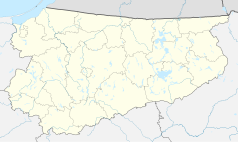
Położenie na mapie Polski (c) Karte: NordNordWest, Lizenz: Creative Commons by-sa-3.0 de | |
| Portal | |
Gołdap Stadion – zlikwidowana stacja kolejowa w Gołdapi na linii kolejowej Gołdap – Gołdap Stadion, w powiecie gołdapskim, w województwie warmińsko-mazurskim, w Polsce.
Bibliografia
- Gołdap Stadion w Ogólnopolskiej Bazie Kolejowej – bazakolejowa.pl
| Gołdap Stadion | ||
| Linia Gołdap – Gołdap Stadion (3,5 km) | ||
odległość: 3,5 km | ||
| Linia Botkuny – Pobłędzie (? km) | ||
odległość: ? km | ||
Media użyte na tej stronie
(c) Karte: NordNordWest, Lizenz: Creative Commons by-sa-3.0 de
Location map of Poland
Autor: SANtosito, Licencja: CC BY-SA 4.0
Location map of Warmian-Masurian Voivodeship. Geographic limits of the map:
- N: 54.52 N
- S: 53.07 N
- W: 19.05 E
- E: 22.95 E
Autor: SANtosito, Licencja: CC BY-SA 4.0
Location map of Gołdap County with urbanized area highlighted. Geographic limits of the map:
- N: 54.38 N
- S: 54.14 N
- W: 21.92 E
- E: 22.83 E
head station, track to the left
head station, track to the left
Straight line aqross (according to naming convention, name + modifier)
head station, track to the right
head station, track to the right
station at track aqross
Autor:
Mapa Gołdapi, Polska


