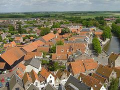
Goeree-Overflakkee
(c) Kjv, CC-BY-SA-3.0 | |||||
| |||||
| Państwo | |||||
|---|---|---|---|---|---|
| Prowincja | Holandia Południowa | ||||
| Burmistrz | Ada Grootenboer-Dubbelman (2014)[1] | ||||
| Powierzchnia | 422,34 km² | ||||
| Populacja (2014) • liczba ludności | 48 233 [2] | ||||
| Nr kierunkowy | 0187 | ||||
| Kod pocztowy | 3240–3258 | ||||
| Strona internetowa | |||||
Goeree-Overflakkee – wyspa i gmina w prowincji Holandia Południowa w Holandii.
Miejscowości
Liczba mieszkańców według stanu na 2012 rok:
- Stellendam - 3.490
- Ouddorp - 6.710
- Goedereede - 2.190
- Dirksland - 5.070
- Melissant - 2.170
- Herkingen - 1.250
- Middelharnis - 6.780
- Sommelsdijk - 7.470
- Nieuwe-Tonge - 2.440
- Stad aan 't Haringvliet - 1.370
- Oude-Tonge - 4.860
- Ooltgensplaat - 2.670
- Den Bommel - 1.690
- Achthuizen - 1.190
- Battenoord - niezamieszkana
- Zuidzijde - 180 (2007)
Przypisy
- ↑ goeree-overflakkee.nl: Samenstelling en taakverdeling college (niderl.). [dostęp 2015-12-20]. [zarchiwizowane z tego adresu (2015-12-22)].
- ↑ Aktualna liczba mieszkańców gminy (nl) [dostęp 11 lipca 2014]
Media użyte na tej stronie
Autor: Erik Frohne, Licencja: CC BY-SA 3.0
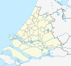
Location map of province South Holland in the Netherlands
Equirectangular projection, N/S stretching 162 %. Geographic limits of the map:
- N: 52.40° N
- S: 51.60° N
- W: 3.80° E
- E: 5.20° E
Coat of arms of the Dutch municipality of Goeree-Overflakkee.
Flag of Goeree-Overflakkee


