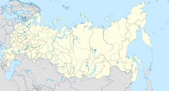
Gorochowiec
| |||||
 | |||||
| Państwo | |||||
| Obwód | |||||
| Data założenia | 1158 | ||||
| Prawa miejskie | 1778 | ||||
| Burmistrz | Alexander Ljutow | ||||
| Powierzchnia | 13 km² | ||||
| Wysokość | 100 m n.p.m. | ||||
| Populacja (2006) • liczba ludności • gęstość | 13 789 1061 os./km² | ||||
| Nr kierunkowy | +7 (49238) | ||||
| Kod pocztowy | 601480 | ||||
| Tablice rejestracyjne | 33 | ||||
| Strona internetowa | |||||
| Portal | |||||
Gorochowiec – miasto w Rosji, w obwodzie włodzimierskim. W 2006 liczyło 13 789 mieszkańców.
Linki zewnętrzne
- Gorochowiec, [w:] Słownik geograficzny Królestwa Polskiego, t. II: Derenek – Gżack, Warszawa 1881, s. 722.
Media użyte na tej stronie
Autor: Виктор В, Licencja: CC BY-SA 2.0
Позиционная карта Владимирской области
- Проекция — равноугольная.
- Стандартная параллель — 56°00′00″с.ш.
- Параметры шаблона (координаты краёв):
|top    = 57.01
|bottom = 25.0
|left   = 39.06
|right  = 25.0
Autor: Uwe Dedering, Licencja: CC BY-SA 3.0
Location map of Russia.
EquiDistantConicProjection : Central parallel :
* N: 54.0° N
Central meridian :
* E: 100.0° E
Standard parallels:
* 1: 49.0° N
* 2: 59.0° N
Made with Natural Earth. Free vector and raster map data @ naturalearthdata.com.
Because the southern Kuril islands are claimed by Russia and Japan, they are shown as disputed. For more information about this see: en:Kuril Islands dispute. These islands are since 1945 under the jurisdiction of the Russian Federation.
Flag of Vladimir Oblast
Gorokhovets (Vladimir Governorate), coat of arms (1781)
Флаг Гороховца Владимирской области


