Grän
 | |||
| |||
| Państwo | |||
|---|---|---|---|
| Kraj związkowy | |||
| Powiat | |||
| Powierzchnia | 20,92 km² | ||
| Wysokość | 1138 m n.p.m. | ||
| Populacja (1 stycznia 2015) • liczba ludności |
| ||
| • gęstość | 29 os./km² | ||
| Numer kierunkowy | 05675 | ||
| Kod pocztowy | 6673 | ||
| Tablice rejestracyjne | RE | ||
| Strona internetowa | |||
Grän – gmina w Austrii, w kraju związkowym Tyrol, w powiecie Reutte. Według Austriackiego Urzędu Statystycznego liczyła 601 mieszkańców (1 stycznia 2015)[1].
Przypisy
Media użyte na tej stronie
Autor: Rosso Robot, Licencja: CC BY-SA 3.0
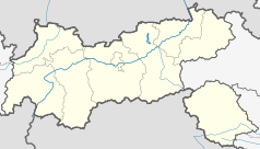
Location map of The Tyrol
Equirectangular projection. Geographic limits of the map:
- N: 47.75317° N
- S: 46.64119° N
- W: 10.08236° E
- E: 12.98961° E
Autor: Lencer, Licencja: CC BY-SA 3.0
Location map of Austria
Equirectangular projection, N/S stretching 150 %. Geographic limits of the map:
- N: 49.2° N
- S: 46.3° N
- W: 9.4° E
- E: 17.2° E
Autor: Df1paw, Licencja: CC BY-SA 3.0
View to Northeast on Grän (1138 m). In the background the aerial tramway up to Füssener Jöchle (1821 m), left of it Lumberger Grat (1860 m) and Seichenkopf (1864 m), on the right Läuferspitze (1956 m) and Haller Schrofen (1934 m).
Blazon:„Sable, above a tree stump gules in the base, a chamois rampant Argent.“
The arms were granted on July 15, 1981. The chamois is a symbol for the medieval privilege of the inhabitants of Grän to hunt some of them each year. In 1650 the privileges were confirmed and from then on it was allowed to use guns for the hunt. The tree stump is a canting symbol. Grän is derived from "Geröne"; it means cleared (forest) area.


