Grand Prairie
(c) Michael Barera, CC BY-SA 4.0 Główna ulica w Grand Prairie. | |
| Państwo | |
|---|---|
| Stan | |
| Powierzchnia | 211 km² |
| Wysokość | 157 m n.p.m. |
| Populacja (2020) • liczba ludności • gęstość | 196 100 1043 os./km² |
| Kod pocztowy | 75050–75054 |
| Strona internetowa | |
| Portal | |
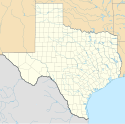
Grand Prairie – miasto w Stanach Zjednoczonych, w stanie Teksas, położone wzdłuż granicy hrabstw Tarrant i Dallas, a niewielka jego część rozciąga się na południe do hrabstwa Ellis. Według spisu z 2020 roku liczy 196,1 tys. mieszkańców[1]. Jest częścią aglomeracji Dallas–Fort Worth.
W mieście rozwinął się przemysł lotniczy, metalowy oraz rakietowy[2].
Urodzeni w Grand Prairie
- Selena Gomez (ur. 22 lipca 1992) – piosenkarka i aktorka[3]
- Eric Vale (ur. 28 kwietnia 1974) – aktor głosowy związany z anime
Linki zewnętrzne
Przypisy
- ↑ U.S. Census Bureau QuickFacts: Grand Prairie city, Texas, www.census.gov [dostęp 2022-01-03] (ang.).
- ↑ Grand Prairie, [w:] Encyklopedia PWN [online] [dostęp 2021-10-03].
- ↑ Famous People From Grand Prairie, Texas - #1 is Selena Gomez, Playback.fm [dostęp 2022-01-03] (ang.).
Media użyte na tej stronie
Autor: Uwe Dedering, Licencja: CC BY-SA 3.0
Location map of the USA (without Hawaii and Alaska).
EquiDistantConicProjection:
Central parallel:
* N: 37.0° N
Central meridian:
* E: 96.0° W
Standard parallels:
* 1: 32.0° N
* 2: 42.0° N
Made with Natural Earth. Free vector and raster map data @ naturalearthdata.com.
Formulas for x and y:
x = 50.0 + 124.03149777329222 * ((1.9694462586094064-({{{2}}}* pi / 180))
      * sin(0.6010514667026994 * ({{{3}}} + 96) * pi / 180))
y = 50.0 + 1.6155950752393982 * 124.03149777329222 * 0.02613325650382181
      - 1.6155950752393982  * 124.03149777329222 *
     (1.3236744353715044  - (1.9694462586094064-({{{2}}}* pi / 180))
      * cos(0.6010514667026994 * ({{{3}}} + 96) * pi / 180))
The flag of Navassa Island is simply the United States flag. It does not have a "local" flag or "unofficial" flag; it is an uninhabited island. The version with a profile view was based on Flags of the World and as a fictional design has no status warranting a place on any Wiki. It was made up by a random person with no connection to the island, it has never flown on the island, and it has never received any sort of recognition or validation by any authority. The person quoted on that page has no authority to bestow a flag, "unofficial" or otherwise, on the island.
Autor: Alexrk, Licencja: CC BY 3.0
Ta mapa została stworzona za pomocą GeoTools.
This map shows the incorporated areas in Dallas County, Texas. Grand Prairie is highlighted in red. I created it in Inkscape using data from the following links: North Central Texas Council of Governments Maps Website, Dallas County Commissioner District Map (PDF)
(c) Michael Barera, CC BY-SA 4.0
East Main Street in Grand Prairie, Texas (United States).


