Grantown-on-Spey
 Grantown-on-Spey zimą | |
| Państwo | |
|---|---|
| Kraj | |
| Hrabstwo | Highland |
| Populacja (2011) • liczba ludności | 2428 |
Położenie na mapie Highland Contains Ordnance Survey data © Crown copyright and database right, CC BY-SA 3.0 | |
Położenie na mapie Wielkiej Brytanii (c) Karte: NordNordWest, Lizenz: Creative Commons by-sa-3.0 de | |
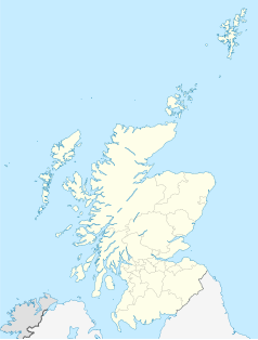
Położenie na mapie Szkocji | |
| Strona internetowa | |
| Portal | |
Grantown-on-Spey (gael. Baile nan Granndach[1]) – miasto w północnej Szkocji, w hrabstwie Highland (historycznie w Elginshire[2]), położone nad rzeką Spey, w dolinie Strathspey, w obrębie parku narodowego Cairngorms[3]. W 2011 roku liczyło 2428 mieszkańców[4].
Grantown założone zostało w 1766 roku przez Jamesa Granta i zaplanowane od podstaw jako wieś przemysłowa. W 1851 roku liczyło ponad 1000 mieszkańców. W epoce wiktoriańskiej stało się popularnym ośrodkiem turystyki; powstały tu wówczas korty tenisowe, pola do gry w bowls oraz pole golfowe. Rozwojowi turystyki sprzyjało dotarcie tutaj w 1863 roku kolei (linia zamknięta w 1965 roku). Miasto pozostaje ośrodkiem turystyki do dnia dzisiejszego, w tym narciarstwa, turystyki pieszej i wędkarstwa[5].
Przypisy
- ↑ Grantown on Spey, www.ainmean-aite.scot [dostęp 2021-10-04].
- ↑ Grantown on Spey (ang.). A vision of Britain through time. [dostęp 2021-10-04].
- ↑ Ordnance Survey, Mapa OS Landranger 36 (Grantown & Aviemore).
- ↑ Search census data: Grantown-on-Spey (Locality 2010) (ang.). Scotland's Census. [dostęp 2021-10-04].
- ↑ Grantown-on-Spey (ang.). Gazetteer for Scotland. [dostęp 2021-10-04].
Media użyte na tej stronie
(c) Karte: NordNordWest, Lizenz: Creative Commons by-sa-3.0 de
Location map of the United Kingdom
Contains Ordnance Survey data © Crown copyright and database right, CC BY-SA 3.0
Blank map of Highland, UK with the following information shown:
- Administrative borders
- Coastline, lakes and rivers
- Roads and railways
- Urban areas
Equirectangular map projection on WGS 84 datum, with N/S stretched 180%
Geographic limits:
- West: 6.9W
- East: 2.9W
- North: 58.8N
- South: 56.4N
(c) Eric Gaba, NordNordWest, CC BY-SA 3.0
Location map of Scotland, United Kingdom
Autor: Clydecoast, Licencja: CC BY-SA 3.0
A winter scene in Grantown-on-Spey


