Great Portland Street
| ||
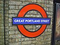
 (c) John Barrett, CC BY-SA 2.0 Budynek stacji | ||
| Państwo | ||
| Kraj | ||
| Miejscowość | Londyn | |
| Data otwarcia | 1863 | |
| Metropolitan Line | ||
| Poprzednia stacja | Baker Street | |
| Następna stacja | Euston Square | |
| Circle Line | ||
| Poprzednia stacja | Baker Street | |
| Następna stacja | Euston Square | |
| Hammersmith & City Line | ||
| Poprzednia stacja | Baker Street | |
| Następna stacja | Euston Square | |
Położenie na mapie City of Westminster  Contains Ordnance Survey data © Crown copyright and database right, CC BY-SA 3.0 | ||
Położenie na mapie Wielkiej Brytanii  (c) Karte: NordNordWest, Lizenz: Creative Commons by-sa-3.0 de | ||
Położenie na mapie Anglii  | ||
Położenie na mapie Wielkiego Londynu  Contains Ordnance Survey data © Crown copyright and database right, CC BY-SA 3.0 | ||
| Portal | ||
Great Portland Street - stacja metra londyńskiego na terenie City of Westminster, leżąca na trasie trzech linii: Circle Line, Hammersmith & City Line oraz Metropolitan Line[1]. Została otwarta 10 stycznia 1863 roku, jako część pierwszego na świecie odcinka metra. Od 1917 roku nosi obecną nazwę[2]. Według danych za rok 2008, korzysta z niej niespełna 7 mln pasażerów rocznie[3]. Należy do pierwszej strefy biletowej[4].
Galeria

Perony
Logo stacji
Przypisy
- ↑ Schemat sieci metra w Londynie [dostęp 2010-12-21]
- ↑ CULG - Metropolitan Line. [dostęp 2010-12-21].
- ↑ Tube performance | Transport for London. [dostęp 2010-12-21].
- ↑ Lista stacji i stref biletowych metra londyńskiego [dostęp 2010-12-21]
| |||||||||||
| ||||||
| |||||||||||||||||
Media użyte na tej stronie
Contains Ordnance Survey data © Crown copyright and database right, CC BY-SA 3.0
Blank map of the City of Westminster, showing electoral wards.
Equirectangular map projection on WGS 84 datum, with N/S stretched 160%
Geographic limits:
- West: 0.22W
- East: 0.1W
- North: 51.55N
- South: 51.48N
(c) Karte: NordNordWest, Lizenz: Creative Commons by-sa-3.0 de
Location map of the United Kingdom
Contains Ordnance Survey data © Crown copyright and database right, CC BY-SA 3.0
Map of Greater London, UK with the following information shown:
- Administrative borders
- Coastline, lakes and rivers
- Roads and railways
- Urban areas
The data includes both primary routes and railway lines.
Equirectangular map projection on WGS 84 datum, with N/S stretched 160%
Geographic limits:
- West: 0.57W
- East: 0.37E
- North: 51.72N
- South: 51.25N


Flag of England. Saint George's cross (a red cross on a white background), used as the Flag of England, the Italian city of Genoa and various other places.


Autor: Sunil060902, Licencja: CC BY-SA 3.0
Great Portland Street tube station platform roundel

Autor: Sunil060902, Licencja: CC BY-SA 3.0
Great Portland Street tube station platforms looking west
