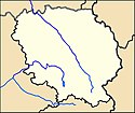
Guéret
| miejscowość i gmina | |||
 Centrum Guéret z lotu ptaka (2011) | |||
| |||
| Państwo | |||
|---|---|---|---|
| Region | |||
| Departament | |||
| Okręg | |||
| Kod INSEE | 23096 | ||
| Powierzchnia | 26,21 km² | ||
| Populacja (1990) • liczba ludności |
| ||
| • gęstość | 561 os./km² | ||
| Kod pocztowy | 23000 | ||
| Strona internetowa | |||
| Portal | |||
Guéret – miejscowość i gmina w środkowej Francji, w regionie Nowa Akwitania, ośrodek administracyjny departamentu Creuse, w przeszłości stolica prowincji Marche[1].
Według danych na rok 1990 gminę zamieszkiwało 14 706 osób, a gęstość zaludnienia wynosiła 561 osób/km² (wśród 747 gmin Limousin Guéret plasuje się na 4. miejscu pod względem liczby ludności, natomiast pod względem powierzchni na miejscu 216.).
Populacja
Współpraca
Przypisy
- ↑ La grande encyclopédie, t. 23, Bibliothèque nationale de France, 1885–1902, s. 34 [dostęp 2022-05-08].
Bibliografia
- Francuski urząd statystyczny. (fr.).
Linki zewnętrzne
Media użyte na tej stronie
Autor: Superbenjamin, Licencja: CC BY-SA 4.0
Blank administrative map of France for geo-location purpose, with regions and departements distinguished. Approximate scale : 1:3,000,000
Autor: Flappiefh, Licencja: CC BY-SA 4.0
Carte administrative vierge de la région Aquitaine-Limousin-Poitou-Charentes, France, destinée à la géolocalisation.
Autor: Chatsam, Licencja: CC BY-SA 3.0
blason de la commune de Guéret : D'azur à la forêt de sinople sur une terrasse du même, au cerf passant d'or brochant sur le tout.
Autor: Drd23, Licencja: CC BY-SA 3.0
Guéret, the Bonnyaud place during the fun fair.
Autor: Wikisoft* @@@-fr 09:35, 20 December 2012 (UTC), Licencja: GFDL
Carte 23 Creuse département fr administrative
Autor: Michiel1972, Licencja: CC BY-SA 3.0
Population - Municipality code 23096.svg
Population Census 1962-2008Drapeau officiel de la Nouvelle-Aquitaine, inspirée du blason officiel.


