Gusiew (krater marsjański)
| ||
 Zdjęcie satelitarne krateru Gusiew; we wnętrzu nakreślona żółta elipsa - rejon lądowania łazika Spirit | ||
| Ciało niebieskie | Mars | |
| Średnica krateru | 175 km | |
| Źródło nazwy | Matwiej Gusiew | |
Gusiew – krater uderzeniowy na Marsie, o średnicy ok. 175 km. Jego współrzędne kartograficzne[a] to ♂ 14,77°S 184,57°W/-14,770000 -184,570000[b]. Nazwę kraterowi nadano w 1976 na cześć rosyjskiego astronoma Matwieja Gusiewa (1826-1866).
Krater ten został wybrany jako miejsce lądowania w 2004 bezzałogowej sondy MER-A, znanej powszechnie pod nazwą Spirit. Spodziewano się, że ten powstały przed około trzema miliardami lat krater uderzeniowy mógł być przez pewien czas wypełniony płynną wodą, a zatem jej ślady mogłoby się udać znaleźć na dnie krateru, będącym też dnem hipotetycznego jeziora, które mogło być zasilane wodą płynącą kanionem Ma'adim Vallis, łączącym się z kraterem od strony południowej. Łazik Spirit prowadził badania do marca 2010 roku.
Zobacz też
- Lista kraterów na Marsie
- Gusiew - krater meteorytowy w Rosji
- Gusiew - miasto w Rosji
Uwagi
- ↑ stosowana jest w tym przypadku nazwa współrzędne areograficzne, analogicznie do terminów współrzędne geograficzne i współrzędne selenograficzne
- ↑ południk zerowy na Marsie wyznaczony został (tak jak na Ziemi południk Greenwich) arbitralnie i przechodzi przez krater Airy-0
Linki zewnętrzne
Media użyte na tej stronie
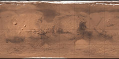
Carte de Mars reconstituée à partir des mesures de Mars Global Surveyor (MOLA) et des observations de Viking.
On January 3, Spirit, NASA's 400-pound rover, is scheduled to land on what may be a dried-up lake bed on Mars. "There's not much doubt: this site contained a body of liquid water, at least for some amount of time," says Jim Garvin, NASA's Lead Scientist for Mars Exploration.
The site is Gusev Crater, a 90-mile wide hole in the ground that probably formed three to four billion years ago when an asteroid crashed just south of Mars' equator. There's a channel system that drains into it, which probably carried liquid water, or water and ice, into the crater. "It's hard to imagine the landscape looking this way unless water was somehow involved," says Garvin.
This image was taken by NASA's Viking 1 orbiter.
Right now, inside the crater, researchers expect to find sediments, which may be nearly 3,000 feet thick. These sediments, which, researchers hope were deposited by water, may have been covered by dust and sand that's blown into the crater over the past two billion years. But if there was once water in Gusev, its signature should still be there.Autor: F l a n k e r, Licencja: CC BY 3.0
symbol of Mars. 16 × 16 pixel nominal dimensions, lines 2 pixel thick, square caps. Colour 75% blue: red=0 green=0 blue=191 (#0000BF).
Shiny LightSteelBlue button/marker widget. Used to mark the location of something such as a tourist attraction.


