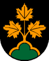
Höhnhart
 | |||
| |||
| Państwo | |||
|---|---|---|---|
| Kraj związkowy | |||
| Powiat | Braunau am Inn | ||
| Powierzchnia | 21,96 km² | ||
| Wysokość | 480 m n.p.m. | ||
| Populacja (1 stycznia 2015) • liczba ludności | 1 410 | ||
| • gęstość | 64 os./km² | ||
| Numer kierunkowy | 07755 | ||
| Kod pocztowy | 5251 | ||
| Tablice rejestracyjne | BR | ||
| Strona internetowa | |||
Höhnhart – miejscowość i gmina w Austrii, w kraju związkowym Górna Austria, w powiecie Braunau am Inn. Liczy 1,4 tys. mieszkańców[1].
Przypisy
Media użyte na tej stronie
Autor: Rosso Robot, Licencja: CC BY-SA 3.0
Location map of Upper Austria
Equirectangular projection. Geographic limits of the map:
- N: 48.78063° N
- S: 47.44388° N
- W: 12.73041° E
- E: 15.00183° E
Autor: Lencer, Licencja: CC BY-SA 3.0
Location map of Austria
Equirectangular projection, N/S stretching 150 %. Geographic limits of the map:
- N: 49.2° N
- S: 46.3° N
- W: 9.4° E
- E: 17.2° E
Autor: Heinrich Wagner - Bildermacher, Licencja: CC BY-SA 4.0
Höhnhart liegt an den Ausläufern des Kobernaußenwaldes inmitten landwirtschatlich genutzter Felder. Die sanften Hügel werden vom "Veiterbach" durchzogen, der bei Altheim in die Altheimer Ache mündet. Die Kirche von Höhnhart ist dem Hl. Jakobus geweiht.


