Hannut
 | |||||
| Państwo | |||||
|---|---|---|---|---|---|
| Region | |||||
| Populacja • liczba ludności |
| ||||
| Nr kierunkowy | 019 | ||||
| Kod pocztowy | 4280 | ||||
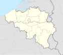
Położenie na mapie Belgii (c) Karte: NordNordWest, Lizenz: Creative Commons by-sa-3.0 de | |||||
| 50,67247°N 5,07800°E/50,672470 5,078000 | |||||
| Strona internetowa | |||||
Hannut – miasto w Belgii, w prowincji Liège. W 2018 roku liczyło 16 435 mieszkańców.
Media użyte na tej stronie
Belgium adm location map.svg
(c) Karte: NordNordWest, Lizenz: Creative Commons by-sa-3.0 de
Location map of Belgium
(c) Karte: NordNordWest, Lizenz: Creative Commons by-sa-3.0 de
Location map of Belgium
Flag of Hannut.svg
Municipal flag of Hannut, Belgium. The municipal flag of Hannut is vertically divided red-green with 18 yellow stars arranged in an ellipse in the middle of the flag.
Municipal flag of Hannut, Belgium. The municipal flag of Hannut is vertically divided red-green with 18 yellow stars arranged in an ellipse in the middle of the flag.
Hannut JPG00.jpg
Autor: Jean-Pol GRANDMONT, Licencja: CC BY 2.0
Hannut, the church of Saint Christopher (XV - XVIIIth centuries).
Autor: Jean-Pol GRANDMONT, Licencja: CC BY 2.0
Hannut, the church of Saint Christopher (XV - XVIIIth centuries).
Blason Hannut.svg
Autor: Evil berry, Licencja: CC BY-SA 4.0
Wapen van Hannut: De gueules, à un château ouvert et crénelé, d'or maçonné de sable, le donjon de même, chargé des armes de Brabant-Limbourg.
Autor: Evil berry, Licencja: CC BY-SA 4.0
Wapen van Hannut: De gueules, à un château ouvert et crénelé, d'or maçonné de sable, le donjon de même, chargé des armes de Brabant-Limbourg.


