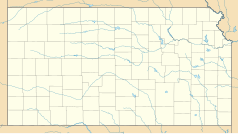
Hays (Kansas)
 | |
| Państwo | |
|---|---|
| Stan | |
| Hrabstwo | |
| Prawa miejskie | 1867 |
| Powierzchnia | 19,7 km² |
| Wysokość | 616 m n.p.m. |
| Populacja (2000) • liczba ludności • gęstość |
|
| Nr kierunkowy | 785 |
| Kod pocztowy | 67601, 67667 |
| Strona internetowa | |
| Portal | |
Hays – miasto w Stanach Zjednoczonych, w stanie Kansas, siedziba hrabstwa Ellis. Ludność: 20 013 (ostatni census z 2000). Stanowi największe miasto północno-zachodniego regionu stanu, teren rolniczy pod uprawą pszenicy, kukurydzy i soi, ongiś wielkie trawiaste prerie wyżynne rojące się od stad bizonów. Miasto leży na skrzyżowaniu autostrady międzystanowej nr 70 i drogi krajowej US Highway 183.
Znajduje się tu kampus uniwersytetu stanowego Fort Hays State University.
Dziki Bill Hickok był tu szeryfem w latach 1869–1870 i przeżył szereg pojedynków na rewolwery. Strona oficjalna miasta podaje, że od sierpnia 1867 do grudnia 1873 zdarzyło się tutaj lub w okolicach 30 zabójstw. Hays City wyrobiło sobie zasłużoną reputację jednego z najniebezpieczniejszych miasteczek kresów kansaskiego Dziki Zachodu.
Pobliski fort armii USA, Fort Hays, jest uwieczniony w oskarowym filmie Tańczący z wilkami jako ostatnie cywilizowane osiedle, z którego wyrusza bohater filmu Kevin Costner.
Bibliografia
- Oficjalna strona internetowa miasta Hays (ang.)
- Historia Hays z oficjalnej strony miasta. haysusa.com. [zarchiwizowane z tego adresu (2008-10-07)]. (ang.)
- Kansas Statistical Abstract. ku.edu. [zarchiwizowane z tego adresu (2006-05-29)]. (ang.)
Media użyte na tej stronie
Autor: Alexrk2, Licencja: CC BY 3.0
Ta mapa została stworzona za pomocą GeoTools.
Autor: Uwe Dedering, Licencja: CC BY-SA 3.0
Location map of the USA (without Hawaii and Alaska).
EquiDistantConicProjection:
Central parallel:
* N: 37.0° N
Central meridian:
* E: 96.0° W
Standard parallels:
* 1: 32.0° N
* 2: 42.0° N
Made with Natural Earth. Free vector and raster map data @ naturalearthdata.com.
Formulas for x and y:
x = 50.0 + 124.03149777329222 * ((1.9694462586094064-({{{2}}}* pi / 180))
      * sin(0.6010514667026994 * ({{{3}}} + 96) * pi / 180))
y = 50.0 + 1.6155950752393982 * 124.03149777329222 * 0.02613325650382181
      - 1.6155950752393982  * 124.03149777329222 *
     (1.3236744353715044  - (1.9694462586094064-({{{2}}}* pi / 180))
      * cos(0.6010514667026994 * ({{{3}}} + 96) * pi / 180))
The flag of Navassa Island is simply the United States flag. It does not have a "local" flag or "unofficial" flag; it is an uninhabited island. The version with a profile view was based on Flags of the World and as a fictional design has no status warranting a place on any Wiki. It was made up by a random person with no connection to the island, it has never flown on the island, and it has never received any sort of recognition or validation by any authority. The person quoted on that page has no authority to bestow a flag, "unofficial" or otherwise, on the island.
Autor: Arkyan, Licencja: CC-BY-SA-3.0
This map shows the incorporated and unincorporated areas in Ellis County, Kansas, highlighting Hays in red. It was created with a custom script with US Census Bureau data and modified with Inkscape.
Autor: Oryginalnym przesyłającym był Catbar z angielskiej Wikipedii, Licencja: CC-BY-SA-3.0
Adapted from Wikipedia's KS county maps by Catbar.
Autor: CityOfHays, Licencja: CC BY-SA 3.0
Stone work signs that greets visitors coming to the City of Hays, KS. Artwork by Pete Felten


