Hemer
 | |||
| |||
| Państwo | |||
|---|---|---|---|
| Kraj związkowy | |||
| Zarządzający | Christian Schweitzer↗ | ||
| Powierzchnia | 67,57 km² | ||
| Wysokość | 210 m n.p.m. | ||
| Populacja (31 grudnia 2010) • liczba ludności • gęstość | 37 735 558 os./km² | ||
| Nr kierunkowy | 02372 | ||
| Kod pocztowy | 58675 | ||
| Tablice rejestracyjne | MK | ||
 | |||
| Strona internetowa | |||
| Portal | |||
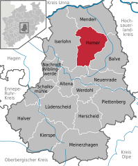
Hemer – miasto w zachodniej części Niemiec, w kraju związkowym Nadrenia Północna-Westfalia, w rejencji Arnsberg, w powiecie Märkischer Kreis, na południowy wschód od Dortmundu. Liczy 37 735 mieszkańców (2010).
Współpraca
Miejscowości partnerskie[1]:
 Beuvry, Francja
 Bretten, Niemcy (Badenia-Wirtembergia)
 Coventry, Wielka Brytania
 Doberlug-Kirchhain, Niemcy (Brandenburgia)
 Obervellach, Austria
 Ojai, Stany Zjednoczone
 Steenwerck, Francja
 Szczołkowo, Rosja.
Przypisy
Linki zewnętrzne
Media użyte na tej stronie
Autor: Hanhil based on previous work by TUBS, Licencja: CC BY-SA 3.0
Location map North Rhine-Westphalia showing position of NRW within Germany. Geographic limits of the map:
Autor: NordNordWest, Licencja: CC BY-SA 3.0
Location map of Germany (Wp article: en:Germany)
The flag of Navassa Island is simply the United States flag. It does not have a "local" flag or "unofficial" flag; it is an uninhabited island. The version with a profile view was based on Flags of the World and as a fictional design has no status warranting a place on any Wiki. It was made up by a random person with no connection to the island, it has never flown on the island, and it has never received any sort of recognition or validation by any authority. The person quoted on that page has no authority to bestow a flag, "unofficial" or otherwise, on the island.
Autor: Asio otus, Licencja: CC-BY-SA-3.0
Türmchenvilla "Villa Prinz" (Denkmal seit 1982) in Hemer.
Autor: TUBS, Licencja: CC BY-SA 3.0
|
|
|
|
|
|
|
|
Autor: Waddehadde, Licencja: CC BY-SA 3.0
Überblick vom Jübergturm über die Landesgartenschau Hemer 2010 (vorne) und die Stadt Hemer


