Herford
 | |||||
| Państwo | |||||
|---|---|---|---|---|---|
| Kraj związkowy | |||||
| Zarządzający | Tim Kähler↗ | ||||
| Powierzchnia | 79,00 km² | ||||
| Wysokość | 56-240 m n.p.m. | ||||
| Populacja (2013) • liczba ludności • gęstość |
| ||||
| Nr kierunkowy | 05221 | ||||
| Kod pocztowy | 32049, 32051, 32052 | ||||
| Tablice rejestracyjne | HF | ||||
 | |||||
| Strona internetowa | |||||
| Portal | |||||
Herford − miasto powiatowe w Niemczech, w kraju związkowym Nadrenia Północna-Westfalia, w rejencji Detmold, siedziba powiatu Herford. Leży niedaleko Bielefeldu.
W 2013 miejscowość liczyła 65 135 mieszkańców. Dla porównania, w połowie 2012 było ich 65 113[1], zaś w 1970 około 65400[2].
W Herfordzie rozwinął się przemysł włókienniczy, drzewny, odzieżowy, maszynowy oraz spożywczy[2].
W mieście znajduje się stacja kolejowa Herford.
Urodzeni w mieście
- Hermann Berghaus - niemiecki kartograf
- Karl Ludwig von Oppeln-Bronikowski - generał pruski
- Matthäus Daniel Pöppelmann - architekt warszawski
- Hans-Heinrich Reckeweg - niemiecki lekarz homeopata
- Otto Weddigen - niemiecki oficer marynarki
- Erich Zepler - brytyjski i niemiecki fizyk i szachista
- Thomas Helmer - niemiecki piłkarz, wielokrotny reprezentant kraju.
- Marian Gold - niemiecki wokalista, kompozytor, lider zespołu Alphaville
Współpraca
Miejscowości partnerskie:
 Celle, Dolna Saksonia
 Fredericia, Dania
 Gorzów Wielkopolski, Polska
 Hameln, Dolna Saksonia
 Hann. Münden, Dolna Saksonia
 Hinckley, Wielka Brytania
 Leutesdorf, Nadrenia-Palatynat
 Manavgat, Turcja
 Quedlinburg, Saksonia-Anhalt
 Quincy, Stany Zjednoczone
 Vodice, Chorwacja
 Mirsk, Polska
Przypisy
- ↑ a b Einwohnerzahlen im Regierungsbezirk Detmold. IT.NRW. [dostęp 2014-08-24].
- ↑ a b Encyklopedia Powszechna PWN. T. 2. G-M. Warszawa: Państwowe Wydawnictwo Naukowe, 1974, s. 193.
Media użyte na tej stronie
Autor: Hanhil based on previous work by TUBS, Licencja: CC BY-SA 3.0
Location map North Rhine-Westphalia showing position of NRW within Germany. Geographic limits of the map:
Autor: NordNordWest, Licencja: CC BY-SA 3.0
Location map of Germany (Wp article: en:Germany)
The flag of Navassa Island is simply the United States flag. It does not have a "local" flag or "unofficial" flag; it is an uninhabited island. The version with a profile view was based on Flags of the World and as a fictional design has no status warranting a place on any Wiki. It was made up by a random person with no connection to the island, it has never flown on the island, and it has never received any sort of recognition or validation by any authority. The person quoted on that page has no authority to bestow a flag, "unofficial" or otherwise, on the island.
Łatwo można dodać ramkę naokoło tej grafiki
Autor: TUBS, Licencja: CC BY-SA 3.0
|
|
|
|
|
|
|
|
Flagge der Stadt Herford, Deutschland. Siehe auch Liste der Flaggen im Kreis Herford für Beschreibung.
Hanseatic Flag
Autor: Tatiana Yagunova / Татьяна Ягунова, Licencja: CC BY-SA 4.0
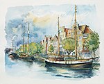
Lubeka (Akwarela Tatiany Yagunovej) — główne miejsce Ligi Hanzeatyckiej. Związek Hanzeatycki — organizację kupiecką pod kierownictwem doświadczonego racjonalnego ośrodka kupieckiego — Wolnego Miasta Lubeki. Opublikowano:
- Nikolay Yagunov, Tatiana Yagunova. Hanza po wiekach. Niemcy. Polska. Rosja. Litwa: album fotografii = Hanse centuries later. Germany. Poland. Russia. Lithuania: the album of photos. — Kaliningrad: Drukarina Bernardinum, 2014. — Pierwszy album.— 208 s. — 2000 egz. — ISBN 978-83-7823-473-9. — S.1 (tytuł książki).
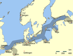
Main trading routes of the Hanseatic League in northern Europe.
Autor: "Ingo Kirschnereit Cyclejakob", Licencja: CC BY 3.0
The Muensterkirche in District of Herford, North Rhine-Westphalia, Germany. During the middleages it was a famous monastery for the education of upperclass daughters. The red building in the front is named the Kantorhaus. It was built around the year 1480 and it is the second oldest house in framework architecture in North Rhine-Westphalia.


