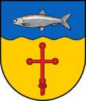
Heringsdorf (Szlezwik-Holsztyn)
| gmina | |||||
 | |||||
| Państwo | |||||
|---|---|---|---|---|---|
| Kraj związkowy | |||||
| Powiat | Ostholstein | ||||
| Wspólnota | Urząd Oldenburg-Land | ||||
| Powierzchnia | 29,42 km² | ||||
| Wysokość | 19 m n.p.m. | ||||
| Populacja (31.12.2008) • liczba ludności | 1066 | ||||
| • gęstość | 36 os./km² | ||||
| Numer kierunkowy | 04365 | ||||
| Kod pocztowy | 23777 | ||||
| Tablice rejestracyjne | OH | ||||
Adres urzędu: Hinter den Höfen 223758 Oldenburg in Holstein | |||||
Położenie na mapie powiatu | |||||
| 54°17′N 11°01′E/54,283333 11,016667 | |||||
| Strona internetowa | |||||
| Portal | |||||
Heringsdorf – gmina w Niemczech w kraju związkowym Szlezwik-Holsztyn, w powiecie Ostholstein, wchodzi w skład urzędu Oldenburg-Land[1].
Przypisy
- ↑ Statistisches Amt für Hamburg und Schleswig-Holstein, Hamburg, 2009.
Media użyte na tej stronie
Gut Siggen, Ost-Holstein.JPG
Autor: Olaf Simons, Licencja: CC BY-SA 3.0
This is a photograph of an architectural monument.
It is on the list of cultural monuments of Heringsdorf
Autor: Olaf Simons, Licencja: CC BY-SA 3.0
This is a photograph of an architectural monument.
It is on the list of cultural monuments of Heringsdorf
Heringsdorf in OH.png
Autor: The map was created by ClausG., Licencja: CC-BY-SA-3.0
This map shows the area of the Gemeinde (municipality) Heringsdorf in the Kreis (district) Ostholstein, Schleswig-Holstein, Germany.
Autor: The map was created by ClausG., Licencja: CC-BY-SA-3.0
This map shows the area of the Gemeinde (municipality) Heringsdorf in the Kreis (district) Ostholstein, Schleswig-Holstein, Germany.
Flagge Heringsdorf (Ostholstein).png
Flagge Heringsdorf (Ostholstein)
Flagge Heringsdorf (Ostholstein)


