Hermeskeil
 | |||
| |||
| Państwo | |||
|---|---|---|---|
| Kraj związkowy | |||
| Powiat | |||
| Powierzchnia | 30,85 km² | ||
| Wysokość | 540 m n.p.m. | ||
| Populacja (31 grudnia 2010) • liczba ludności • gęstość |
| ||
| Nr kierunkowy | 06503 | ||
| Kod pocztowy | 54411 | ||
| Tablice rejestracyjne | TR, SAB | ||
| Strona internetowa | |||
| Portal | |||
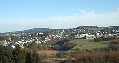
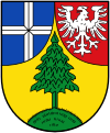
Hermeskeil – miasto w Niemczech, w kraju związkowym Nadrenia-Palatynat, w powiecie Trier-Saarburg, siedziba gminy związkowej Hermeskeil. Miastem partnerskim jest polskie miasto Hel[1].
Przypisy
- ↑ Hermeskeiler Schüler besuchen polnische Partnerstadt Hel, volksfreund.de [dostęp 2022-01-23] (niem.).
Bibliografia
- Statistisches Landesamt Rheinland-Pfalz, Bad Ems
Media użyte na tej stronie
Autor: Hanhil based on work by TUBS, Licencja: CC BY-SA 3.0
Location map Rhineland-Palatinate, showing position of Rhineland-Palatinate within Germany. Geographic limits of the map:
Autor: NordNordWest, Licencja: CC BY-SA 3.0
Location map of Germany (Wp article: en:Germany)
Civil and state flag of the state Rhineland-Palatinate


