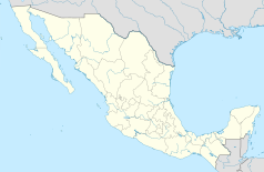
Hidalgo del Parral
| |||
| Państwo | |||
|---|---|---|---|
| Stan | |||
| Data założenia | 1631 | ||
| Burmistrz | César Dajlala Amaya PRI | ||
| Wysokość | 1620 m n.p.m. | ||
| Populacja (2010) • liczba ludności |
| ||
| Nr kierunkowy | 627 | ||
| Kod pocztowy | 31104 | ||
| Strona internetowa | |||
Hidalgo del Parral – miasto i siedziba gminy w północnym Meksyku, w południowej części stanu Chihuahua, około 220 km od stolicy stanu Chihuahua, u podnóży gór Sierra Madre Zachodnia. W 2010 roku miasto liczyło 104 836 mieszkańców. Miasto po założeniu przez hiszpańskich kolonistów nazywało się San José del Parral, lecz po odzyskaniu niepodległości dla uczczenia ojca narodu Miguela Hidalgo y Costilla nazwę zmieniono.
Współpraca
Zobacz też
Przypisy
- ↑ Principales resultados por localidad 2010 (ITER). Instituto Nacional de Estadística, Geografía e Informática.. [dostęp 2015-08-03]. (hiszp.).
Media użyte na tej stronie
The flag of Navassa Island is simply the United States flag. It does not have a "local" flag or "unofficial" flag; it is an uninhabited island. The version with a profile view was based on Flags of the World and as a fictional design has no status warranting a place on any Wiki. It was made up by a random person with no connection to the island, it has never flown on the island, and it has never received any sort of recognition or validation by any authority. The person quoted on that page has no authority to bestow a flag, "unofficial" or otherwise, on the island.
The Flag of India. The colours are saffron, white and green. The navy blue wheel in the center of the flag has a diameter approximately the width of the white band and is called Ashoka's Dharma Chakra, with 24 spokes (after Ashoka, the Great). Each spoke depicts one hour of the day, portraying the prevalence of righteousness all 24 hours of it.
(c) Lyricmac z angielskiej Wikipedii, CC BY-SA 3.0
Plaza Guillermo Baca in Parral, Chihuahua, Mexico.Taken by me in 1992
Autor: Sin autor, Licencja: CC BY-SA 4.0
Escudo de Hidalgo del Parral Chihuahua México
Location Map of Chihuahua Equirectangular projection, Geographic limits of the map:
- N: 32.03° N
- S: 25.45° N
- W: 109.47° W
- E: 102.82° W
Coat of arms of Chihuahua


