High Street Kensington
| ||
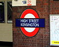
 Główne wejście na stację | ||
| Państwo | ||
| Kraj | ||
| Miejscowość | Londyn | |
| Data otwarcia | 1868 | |
| District Line | ||
| Poprzednia stacja | Earl’s Court | |
| Następna stacja | Notting Hill Gate[1] | |
| Circle Line | ||
| Poprzednia stacja | Gloucester Road | |
| Następna stacja | Notting Hill Gate | |
Położenie na mapie gminy Kensington and Chelsea  Contains Ordnance Survey data © Crown copyright and database right, CC BY-SA 3.0 | ||
Położenie na mapie Wielkiej Brytanii  (c) Karte: NordNordWest, Lizenz: Creative Commons by-sa-3.0 de | ||
Położenie na mapie Anglii  | ||
Położenie na mapie Wielkiego Londynu  Contains Ordnance Survey data © Crown copyright and database right, CC BY-SA 3.0 | ||
| Portal | ||
High Street Kensington - stacja metra londyńskiego na terenie Royal Borough of Kensington and Chelsea, leżąca na trasie dwóch linii: District Line oraz Circle Line[2]. Została otwarta w 1868 roku[3]. W 2007 roku skorzystało z niej ok. 12,603 mln pasażerów[4]. Należy do pierwszej strefy biletowej[5].
Galeria
Logo stacji

Przejście na stację z sąsiadującego z nią centrum handlowego

Perony stacji w 1892 roku
 (c) Ray Stanton, CC BY-SA 2.0
Perony współcześnie
Przypisy
- ↑ Niektóre pociągi District Line kończą bieg na High Street Kensington, stąd stacja wyposażona jest w miejsca postojowe, gdzie składy oczekują na początek kolejnego kursu.
- ↑ Schemat sieci metra w Londynie [dostęp 2010-12-18]
- ↑ CULG - District Line. [dostęp 2010-12-18].
- ↑ Tube performance | Transport for London. [dostęp 2010-12-18].
- ↑ Lista stacji i stref biletowych metra londyńskiego [dostęp 2010-12-18]
| |||||||||||
| |||||||||||||||||||||
Media użyte na tej stronie
(c) Karte: NordNordWest, Lizenz: Creative Commons by-sa-3.0 de
Location map of the United Kingdom
Contains Ordnance Survey data © Crown copyright and database right, CC BY-SA 3.0
Map of Greater London, UK with the following information shown:
- Administrative borders
- Coastline, lakes and rivers
- Roads and railways
- Urban areas
The data includes both primary routes and railway lines.
Equirectangular map projection on WGS 84 datum, with N/S stretched 160%
Geographic limits:
- West: 0.57W
- East: 0.37E
- North: 51.72N
- South: 51.25N


Flag of England. Saint George's cross (a red cross on a white background), used as the Flag of England, the Italian city of Genoa and various other places.


(c) Ray Stanton, CC BY-SA 2.0
High Street Kensington underground station On the Circle and District lines
Contains Ordnance Survey data © Crown copyright and database right, CC BY-SA 3.0
Blank map of the Royal Borough of Kensington and Chelsea, showing electoral wards.
Equirectangular map projection on WGS 84 datum, with N/S stretched 160%
Geographic limits:
- West: 0.235W
- East: 0.145W
- North: 51.535N
- South: 51.475N


Inside the shopping mall where High Street Kensington Tube Station is, January 17, 2008


High Street Kensington Underground station in 1892. Picture shows signs showing where the First and third class coaches will arrive. Most First class journeys on the underground were discontinued in 1940 as part of the war effort. Trains to Aylesbury and Watford had First class accommodation until 1941.