Highgate (stacja metra)
| ||
 Jedno z wejść na stację | ||
| Państwo | ||
| Data otwarcia | 1867, 1941 | |
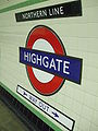
| Northern Line | ||
| Poprzednia stacja | East Finchley | |
| Następna stacja | Archway | |
Położenie na mapie gminy Haringey  Contains Ordnance Survey data © Crown copyright and database right, CC BY-SA 3.0 | ||
Położenie na mapie Wielkiej Brytanii  (c) Karte: NordNordWest, Lizenz: Creative Commons by-sa-3.0 de | ||
Położenie na mapie Anglii  | ||
Położenie na mapie Wielkiego Londynu  Contains Ordnance Survey data © Crown copyright and database right, CC BY-SA 3.0 | ||
| Portal | ||
Highgate (czyt. ˈhaɪɡeɪt lub ˈhaɪɡɨt) – stacja metra londyńskiego położona w dzielnicy Haringey. Leży na trasie jednego z północnych odgałęzień Northern Line.
Stacja powstała w 1867 jako część sieci kolejowej. Perony znajdowały się wówczas na powierzchni ziemi. W 1941 oddano do użytku część podziemną, eksploatowaną przez metro[1]. Należy do trzeciej strefy biletowej[2].
W 1954 stacja została opuszczona przez kolej, zaś metro stało się jej jedynym użytkownikiem. Korzysta z niej ok. 4,5 mln pasażerów rocznie[3].
Galeria
 (c) Hywel Williams, CC BY-SA 2.0
Dawne naziemne perony kolejowe, nieużywane od 1954
Logo stacji

Jeden z peronów
Przypisy
- ↑ Northern Line w serwisie Clive's UndergrounD Line Guides [dostęp 2010-11-24]
- ↑ Lista stacji i stref biletowych metra londyńskiego [dostęp 2010-11-24]
- ↑ Transport for London [dostęp 24.08.2008]
| Odgałęzienie High Barnet | |
|---|---|
| Odgałęzienie Edgware | |
| Odgałęzienie Charing Cross | |
| Odgałęzienie Bank | |
| Odgałęzienie Morden |
![]()
| Metro | |
|---|---|
| National Express East Anglia |
|
| First Capital Connect |
|
| London Overground |

Media użyte na tej stronie
(c) Karte: NordNordWest, Lizenz: Creative Commons by-sa-3.0 de
Location map of the United Kingdom
Contains Ordnance Survey data © Crown copyright and database right, CC BY-SA 3.0
Map of Greater London, UK with the following information shown:
- Administrative borders
- Coastline, lakes and rivers
- Roads and railways
- Urban areas
The data includes both primary routes and railway lines.
Equirectangular map projection on WGS 84 datum, with N/S stretched 160%
Geographic limits:
- West: 0.57W
- East: 0.37E
- North: 51.72N
- South: 51.25N


Autor: Sunil060902, Licencja: CC-BY-SA-3.0
Roundel on Highgate tube station platform
Autor: Sunil060902, Licencja: CC-BY-SA-3.0
Highgate tube station eastern entrance on Priory Gardens. Note remains of the high-level station behind the entrance, and Archway Road (the A1) on the embankment in the background.


(c) Hywel Williams, CC BY-SA 2.0
Highgate Underground station - abandoned high level platforms
Autor: Image:LondonHaringey.png by Morwen, Image:BlankMap-LondonBoroughs.svg by Richtom80, Licencja: CC BY 2.5
Ta ^specifik^ z W3C grafika wektorowa została stworzona za pomocą Inkscape.

Autor: Sunil060902, Licencja: CC BY-SA 3.0
Highgate tube station southbound platform looking north
Contains Ordnance Survey data © Crown copyright and database right, CC BY-SA 3.0
Blank map of the London Borough of Haringey, showing electoral wards.
Equirectangular map projection on WGS 84 datum, with N/S stretched 160%
Geographic limits:
- West: 0.18W
- East: 0.035W
- North: 51.62N
- South: 51.55N