Hinckley
| ||
 Stacja kolejowa w Hinckley | ||
| Państwo | ||
| Kraj | ||
| Hrabstwo | Leicestershire | |
| Dystrykt | Hinckley and Bosworth | |
| Populacja (2001) • liczba ludności | 43 246[1] | |
| Nr kierunkowy | 01455 | |
| Kod pocztowy | LE10 | |
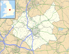
Położenie na mapie Leicestershire Contains Ordnance Survey data © Crown copyright and database right, CC BY-SA 3.0 | ||
Położenie na mapie Wielkiej Brytanii (c) Karte: NordNordWest, Lizenz: Creative Commons by-sa-3.0 de | ||
| Portal | ||
Hinckley – miasto w Anglii, w hrabstwie Leicestershire, w dystrykcie Hinckley and Bosworth. Leży 19 km na południowy zachód od miasta Leicester i 143 km na północny zachód od Londynu[2]. W 2001 miasto liczyło 43 246 mieszkańców[1].
Hinckley znajduje się niedaleko większego miasta Nuneaton (hrabstwo Warwickshire).
Historia
Początek historii miasteczka Hinckley sięga czasów anglosaskich; nazwa Hinckley pochodzi od anglosaskiego „Hinck”, które jest kogoś imieniem oraz „ley”, które oznacza łąkę. Na podstawie katastru gruntowego Domesday Book (sporządzonego na żądanie Wilhelma Zdobywcy w pobitej przez niego Anglii) z 1086 roku, Hinckley było sporej wielkości osadą a w przeciągu 200 lat rozrosło się do rangi małego miasteczka – powstanie rynku po raz pierwszy zostało zanotowane w roku 1311. W Hinckley można znaleźć ślady anglosaskiego kościoła – resztki zegara słonecznego z czasów anglosaskich są widoczne w południowo-wschodnim rogu prezbiterium miejscowego kościoła. W 2000 roku, archeolodzy odkryli ślady z epoki żelaza oraz rzymsko-brytyjskiego osadnictwa obok Coventry Road oraz Watling Street.
Miasta partnerskie
 Le Grand-Quevilly, Francja
 Herford, Niemcy
 Midland, Stany Zjednoczone
Przypisy
- ↑ a b Populacja według spisu ludności 2001. Dane dostępne ze strony https://www.nomisweb.co.uk/home/census2001.asp
- ↑ Hinckley na mapie (ang.). getamap.ordnancesurvey.co.uk. [dostęp 2010-10-06].
Media użyte na tej stronie
(c) Karte: NordNordWest, Lizenz: Creative Commons by-sa-3.0 de
Location map of the United Kingdom
Flag of England. Saint George's cross (a red cross on a white background), used as the Flag of England, the Italian city of Genoa and various other places.
The flag of Navassa Island is simply the United States flag. It does not have a "local" flag or "unofficial" flag; it is an uninhabited island. The version with a profile view was based on Flags of the World and as a fictional design has no status warranting a place on any Wiki. It was made up by a random person with no connection to the island, it has never flown on the island, and it has never received any sort of recognition or validation by any authority. The person quoted on that page has no authority to bestow a flag, "unofficial" or otherwise, on the island.
Contains Ordnance Survey data © Crown copyright and database right, CC BY-SA 3.0
Map of Leicestershire, UK with the following information shown:
- Administrative borders
- Coastline, lakes and rivers
- Roads and railways
- Urban areas
Equirectangular map projection on WGS 84 datum, with N/S stretched 160%
Geographic limits:
- West: 1.80W
- East: 0.50W
- North: 53.00N
- South: 52.36N
Autor: Alexandra Lanes, Licencja: Copyrighted free use
The station building at Hinckley railway station
Autor: Lajsikonik, Licencja: CC BY-SA 4.0
Herb Hinckley, Leicestershire. Arms: Party per pale indented argent and gules


