Hirakata
| |||||||
 Dworzec kolejowy Hirakata | |||||||
| |||||||
| Państwo | |||||||
|---|---|---|---|---|---|---|---|
| Prefektura | Ōsaka | ||||||
| Wyspa | |||||||
| Region | |||||||
| Burmistrz | Hiroshi Nakatsuka | ||||||
| Powierzchnia | 65,08 km² | ||||||
| Populacja (1 II 2008) • liczba ludności • gęstość |
| ||||||
| Symbole japońskie | |||||||
| Drzewo | |||||||
| Kwiat | |||||||
| Ptak | zimorodek | ||||||
| Strona internetowa | |||||||
| Portal | |||||||
Hirakata (jap. 枚方市 Hirakata-shi) – miasto położone w zachodniej części wyspy Honsiu (Honshū), w prefekturze Osaka, w Japonii.
Położenie
Miasto leży w północnej części prefektury. Graniczy z:
Historia
Status miasta szczebla -shi (市) otrzymało 1 sierpnia 1947 roku.
Miasta partnerskie
 Japonia: Shimanto (od 1974), Betsukai i Takamatsu (oba od 1987)
 Australia: Logan (od 1995)
 Chiny: Changning (dzielnica Szanghaju; od 1987)
Media użyte na tej stronie
Autor: Maximilian Dörrbecker (Chumwa), Licencja: CC BY-SA 3.0
Location map of Japan
Equirectangular projection.
Geographic limits to locate objects in the main map with the main islands:
- N: 45°51'37" N (45.86°N)
- S: 30°01'13" N (30.02°N)
- W: 128°14'24" E (128.24°E)
- E: 149°16'13" E (149.27°E)
Geographic limits to locate objects in the side map with the Ryukyu Islands:
- N: 39°32'25" N (39.54°N)
- S: 23°42'36" N (23.71°N)
- W: 110°25'49" E (110.43°E)
- E: 131°26'25" E (131.44°E)
Emblem of Hirakata, Osaka
Autor: Lincun, Licencja: CC BY-SA 3.0
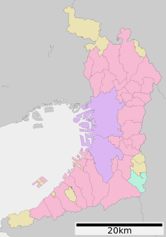
Map of Osaka Prefecture, Japan.
Autor: NISHIGUCHI,Masahiro (nisiguti), Licencja: CC-BY-SA-3.0
South side of Keihan Electric Railway Hirakatashi Station in Hirakata City, Osaka Prefecture, Japan
Flag of Hirakata, Osaka


