Hloubětín
| Część miasta Pragi | |
 Zdjęcie lotnicze Hloubětínu | |
| Państwo | |
|---|---|
| Miasto | |
| Powierzchnia | 5,45 km² |
| Populacja (2008) • liczba ludności |
|
| • gęstość | 2188 os./km² |
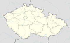
Położenie na mapie Czech (c) Karte: NordNordWest, Lizenz: Creative Commons by-sa-3.0 de | |
| Portal | |
Hloubětín – część Pragi. W 2010 r. zamieszkiwało ją 11 900 mieszkańców.
Media użyte na tej stronie
Czech Republic adm location map.svg
(c) Karte: NordNordWest, Lizenz: Creative Commons by-sa-3.0 de
Location map of the Czech Republic
(c) Karte: NordNordWest, Lizenz: Creative Commons by-sa-3.0 de
Location map of the Czech Republic
Prague location map.png
Autor:
Map of Prague, Czech Republic
Autor:
OpenStreetMap contributors
,
Licencja: CC BY-SA 2.0
Map of Prague, Czech Republic
Praha CoA CZ.svg
Prague coat of arms.
Prague coat of arms.
Hloubětín okolí kostela.jpg
Hloubětín, former centre of village, church vicinity.
Hloubětín, former centre of village, church vicinity.


