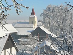
Hlubočec
 Hlubočec | |||||
| |||||
| Państwo | |||||
|---|---|---|---|---|---|
| Kraj | |||||
| Powiat | |||||
| Populacja (2012) • liczba ludności |
| ||||
| Kod pocztowy | 747 69 | ||||
| Tablice rejestracyjne | OP | ||||
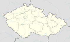
Położenie na mapie Czech (c) Karte: NordNordWest, Lizenz: Creative Commons by-sa-3.0 de | |||||
| Strona internetowa | |||||
| Portal | |||||
Hlubočec – wieś w Czechach, w kraju morawsko-śląskim, w okresie Opawa. Według danych z dnia 1 stycznia 2012 roku liczyła 577 mieszkańców[1].
Przypisy
- ↑ Počty obyvatel v obcích k 1. 1. 2012. www.mvcr.cz. [dostęp 2012-02-16]. (cz.).
Media użyte na tej stronie
Moravian-Silesian Region - outline map.svg
Autor: Caroig, Licencja: CC BY-SA 3.0
Outline map of the Moravian-Silesian Region, Czechia, ready for the Geobox template, calibrated at en:Template:Geobox locator Moravian-Silesian Region
Autor: Caroig, Licencja: CC BY-SA 3.0
Outline map of the Moravian-Silesian Region, Czechia, ready for the Geobox template, calibrated at en:Template:Geobox locator Moravian-Silesian Region
Czech Republic adm location map.svg
(c) Karte: NordNordWest, Lizenz: Creative Commons by-sa-3.0 de
Location map of the Czech Republic
(c) Karte: NordNordWest, Lizenz: Creative Commons by-sa-3.0 de
Location map of the Czech Republic
Flag of Moravian-Silesian Region.svg
Flag of Moravian-Silesian Region
Flag of Moravian-Silesian Region
Flag of Hlubočec.gif
Flag of Hlubočec
Flag of Hlubočec
Hlubočec CoA.jpg
Coat of arms of Hlubočec, Opava District
Coat of arms of Hlubočec, Opava District


