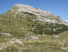
Hoher Ifen
 | |
| Państwo | |
|---|---|
| Położenie | |
| Pasmo | |
| Wysokość | 2230 m n.p.m. |
Hoher Ifen lub Hochifen – szczyt w Alpach Algawskich, części Alp Bawarskich. Leży na granicy między Austrią (Vorarlberg), a Niemcami (Bawaria).
Bibliografia
Media użyte na tej stronie
Autor: Uwe Dedering, Licencja: CC BY-SA 3.0
Location map of Austria
Equirectangular projection, N/S stretching 150 %. Geographic limits of the map:
- N: 49.2° N
- S: 46.3° N
- W: 9.4° E
- E: 17.2° E
Black up-pointing triangle ▲, U+25B2 from Unicode-Block Geometric Shapes (25A0–25FF)
Autor: NordNordWest, Licencja: CC BY-SA 3.0 de
Location map of Vorarlberg
Equirectangular projection. Geographic limits of the map:
- N: 47.62 N
- S: 46.82 N
- W: 9.45 E
- E: 10.3 E
selbst aufgenommen


