Hollands Kroon
| |||||
 | |||||
| Państwo | |||||
| Prowincja | |||||
| Burmistrz | Jaap Nawijn (2014)[1] | ||||
| Powierzchnia | 662,20 km² | ||||
| Populacja (2014) • liczba ludności | 47 501[2] | ||||
| Kod pocztowy | 1730–1736 | ||||
| Strona internetowa | |||||
Hollands Kroon – gmina w Holandii, w prowincji Holandia Północna. Gminę utworzono 1 stycznia 2012 z połączenia gmin Wieringen, Wieringermeer, Anna Paulowna i Niedorp.
Miejscowości
Anna Paulowna, Barsingerhorn, Breezand, De Strook, De Haukes, Den Oever, Haringhuizen, Hippolytushoef, Kleine Sluis, Kolhorn, Kreil, Kreileroord, Lutjewinkel, Middenmeer, Moerbeek, Nieuwe Niedorp, Nieuwesluis, Oosterklief, Oosterland, Oude Niedorp, Slootdorp, Smerp, Stroe, Terdiek, Tolke, Van Ewijcksluis, Vatrop, 't Veld, Verlaat, Westerklief, Westerland, Wieringerwaard, Wieringerwerf, Winkel, Zijdewind.
Przypisy
- ↑ hollandskroon.nl: Burgemeester J.R.A. Nawijn (niderl.). [dostęp 2016-11-10].
- ↑ Aktualna liczba mieszkańców gminy (nl) [dostęp 19 lipca 2014]
Media użyte na tej stronie
Autor: Erik Frohne, Licencja: CC BY-SA 3.0
Location map of province North Holland in the Netherlands
Equirectangular projection, N/S stretching 165 %. Geographic limits of the map:
- N: 53.20° N
- S: 52.10° N
- W: 4.30° E
- E: 5.40° E
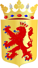
Coat of arms of the Dutch municipality of Hollands Kroon.
Autor: Dolfy, Licencja: CC-BY-SA-3.0
- Uitgaanscentrum van Anna Paulowna, in wat eigenlijk Kleine Sluis is/was.
- Center of Anna Paulowna, in what is original Kleine Sluis.


