Hongshui He
(c) jiang-wen-jie, CC BY-SA 3.0 | |
| Kontynent | |
|---|---|
| Państwo | |
| Lokalizacja | |
| Rzeka | |
| Długość | 638 km |
| Źródło | |
| Miejsce | połączenie Beipan He i Nanpan He |
| Miejsce | ?↗ |
| Współrzędne | |
| Mapa | |
 | |
Hongshui He (chiń. 红水河) – duża rzeka w południowych Chinach w Regionie Autonomicznym Kuangsi-Czuang. Jest jedną z głównych rzek w basenie rzeki Xi Jiang, który tworzy główny dopływ Rzeki Perłowej. Rzeka Honghsui powstaje z połączenia rzek Beipan He i Nanpan He przy granicy z prowincją Kuejczou[1].
Na rzece znajduje się 10 dużych zapór produkujących energię elektryczną i zapobiegające powodziom[2].
Kilka zapór wyposażono w windy wodne dla podnoszenia statków mających do 300 ton wyporności[3].
Przypisy
- ↑ Hongshui River, [w:] Encyclopædia Britannica [online] [dostęp 2020-06-07] (ang.).
- ↑ Hydroelectric Projects. gxed.com, 2005-07-28. [dostęp 2020-06-07]. (ang.).
- ↑ LAN XINZHEN: Harnessing the Hongshuihe. bjreview.com.cn, 2008-10-28. [dostęp 2020-06-07]. (ang.).
Media użyte na tej stronie
Autor: Uwe Dedering, Licencja: CC BY-SA 3.0
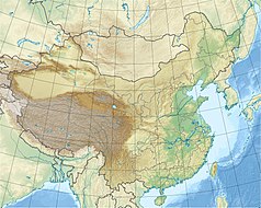
Location map of China.
EquiDistantConicProjection : Central parallel :
* N: 36.0° N
Central meridian :
* E: 104.0° E
Standard parallels :
* 1: 30.0° N
* 2: 42.0° N
Latitudes on the central meridian :
* top: 57.0° N
* center: 37.29° N
* bottom: 17.96° N
Made with Natural Earth. Free vector and raster map data @ naturalearthdata.com.
Autor: Kmusser, Licencja: CC BY-SA 3.0
Map of the tributaries of the Pearl River, and the Pearl River Basin (watershed/drainage basin) in yellow.
- The Lubao Yong and Xinan Yong converge with the Liuxi River to form the main branch of the Pearl River just north of Guangzhou.
- The long and wide Pearl River Delta includes the dense network of cities that span nine prefectures of Guangdong Province, into the South China Sea.


