Hospital de Móstoles
 | |
| Państwo | |
|---|---|
| Wspólnota autonomiczna | |
| Data otwarcia | 11 kwietnia 2003 |
| Poprzednia stacja | Pradillo |
| Następna stacja | Manuela Malasaña |
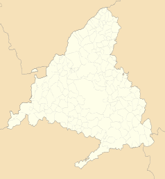
Położenie na mapie wspólnoty autonomicznej Madrytu (c) Miguillen, CC BY-SA 3.0 | |
| Portal | |
Hospital de Móstoles – stacja metra w Madrycie, na linii 12. Znajduje się w Móstoles, pomiędzy stacjami Pradillo i Manuela Malasaña. Została otwarta 11 kwietnia 2003 roku[1].
Przypisy
- ↑ Madrid Metro - Línea 12 (ang.). UrbanRail.net. [dostęp 2012-11-19].
Linki zewnętrzne
- Strona stacji (hiszp.). [dostęp 2010-10-15].
- Metro de Madrid (hiszp.). [dostęp 2010-10-15].
Media użyte na tej stronie
Autor: NordNordWest, Licencja: CC BY-SA 3.0
Location map of Spain
Equirectangular projection, N/S stretching 130 %. Geographic limits of the map:
- N: 44.4° N
- S: 34.7° N
- W: 9.9° W
- E: 4.8° E
Autor: Pedro A. Gracia Fajardo, escudo de Manual de Imagen Institucional de la Administración General del Estado, Licencja: CC0
Flaga Hiszpanii
Logo metra w Madrycie
Autor: See file history, Licencja: CC0
Flag of the Community of Madrid (Spain)
Autor: Cuenqui, Licencja: CC BY-SA 4.0
Vista de los andenes de la estación de Hospital de Móstoles


