Houten
| |||||
 | |||||
| Państwo | |||||
|---|---|---|---|---|---|
| Prowincja | Utrecht | ||||
| Burmistrz | Wouter de Jong (2014)[1] | ||||
| Powierzchnia | 58,99 km² | ||||
| Populacja • liczba ludności | 48 471[2] | ||||
| Kod pocztowy | 3990–3999 | ||||
| Strona internetowa | |||||
Houten – gmina w Holandii, w prowincji Utrecht.
Miejscowości
't Goy, Houten, Schalkwijk, Tull en 't Waal.
Przypisy
- ↑ houten.nl: College van B&W (niderl.). [dostęp 2014-07-28]. [zarchiwizowane z tego adresu (2014-04-09)].
- ↑ Aktualna liczba mieszkańców gminy (nl) [dostęp 28 lipca 2014]
Media użyte na tej stronie
Flag of Houten, Utrecht, the Netherlands.
Autor: Antoine , Licencja: CC BY-SA 3.0
Railway station and town hall to the Onderdoor 25 in Houten in the Netherlands
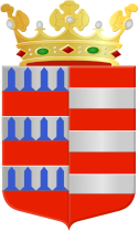
Coat of arms of the Dutch municipality of Houten, Utrecht.
Autor: Erik Frohne, Licencja: CC BY-SA 3.0
Location map of province Utrecht in the Netherlands
Equirectangular projection, N/S stretching 163 %. Geographic limits of the map:
- N: 52.40° N
- S: 51.90° N
- W: 4.70° E
- E: 5.70° E


