Hrabstwo Hart (Georgia)
| hrabstwo | |
 | |
| Państwo | |
|---|---|
| Stan | |
| Siedziba | Hartwell |
| Powierzchnia | 664 km²[1] |
| Populacja (2020) • liczba ludności |
|
| • gęstość | 43 os./km² |
| Strefa czasowa | |
Położenie na mapie Georgia | |
| Portal | |

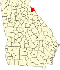
Hrabstwo Hart (ang. Hart County) – hrabstwo w północno-wschodniej części stanu Georgia w Stanach Zjednoczonych. Jego siedzibą administracyjną jest Hartwell.
Geografia
Według spisu z 2000 roku obszar całkowity hrabstwa obejmuje powierzchnię 256,4 mil2 (664 km2), z czego 232,2 mil2 (601 km2) stanowią lądy, a 24,21 mil2 (64 km2) stanowią wody. Hrabstwo obejmuje znaczną część jeziora Hartwell.
Miejscowości
- Bowersville
- Hartwell
CDP
- Eagle Grove
- Reed Creek
Główne drogi
 Autostrada międzystanowa nr 85
 Droga krajowa Stanów Zjednoczonych nr 29
Sąsiednie hrabstwa
- Hrabstwo Oconee, Karolina Południowa (północ)
- Hrabstwo Anderson, Karolina Południowa (północny wschód)
- Hrabstwo Elbert (południe)
- Hrabstwo Madison (południowy zachód)
- Hrabstwo Franklin (zachód)
Demografia
Według spisu w 2020 roku hrabstwo liczy 25,8 tys. mieszkańców, co oznacza wzrost o 2,4% od poprzedniego spisu z roku 2010. 74,8% stanowiły białe społeczności nielatynoskie, 18,5% to Afroamerykanie lub czarnoskórzy, 3,9% to Latynosi, 1,8% było rasy mieszanej, 1,3% deklarowało pochodzenie azjatyckie i 0,3% to rdzenna ludność Ameryki[2].
Religia
W 2010 roku większość mieszkańców to ewangelikalni protestanci. Pod względem członkostwa przeważali południowi baptyści (47,3%), katolicy (10,5%) i zjednoczeni metodyści (7,5%)[3].
Polityka
Hrabstwo jest silnie republikańskie, gdzie w wyborach prezydenckich w 2020 roku, 74,3% głosów otrzymał Donald Trump i 24,8% przypadło dla Joe Bidena[4].
Przypisy
- ↑ US Census Bureau: Georgia County. Population, Housing Units, Area, and Density: 2010. [dostęp 2012-04-18]. (ang.).
- ↑ U.S. Census Bureau QuickFacts: Hart County, Georgia, www.census.gov [dostęp 2022-09-29] (ang.).
- ↑ Congregational Membership, www.thearda.com [dostęp 2022-09-29].
- ↑ Georgia presidential election results 2020: Live results and polls, www.nbcnews.com [dostęp 2022-09-29].
Media użyte na tej stronie
The flag of Navassa Island is simply the United States flag. It does not have a "local" flag or "unofficial" flag; it is an uninhabited island. The version with a profile view was based on Flags of the World and as a fictional design has no status warranting a place on any Wiki. It was made up by a random person with no connection to the island, it has never flown on the island, and it has never received any sort of recognition or validation by any authority. The person quoted on that page has no authority to bestow a flag, "unofficial" or otherwise, on the island.
This is a locator map showing Hart County in Georgia. For more information, see Commons:United States county locator maps.
Autor: Valerie, Licencja: CC BY 2.0
Cokesbury Church, Hart County, GA
600 mm × 600 mm (24 in × 24 in) U.S. Highway shield, made to the specifications of the 2004 edition of Standard Highway Signs. (Note that there is a missing "J" label on the left side of the diagram.) Uses the Roadgeek 2005 fonts. (United States law does not permit the copyrighting of typeface designs, and the fonts are meant to be copies of a U.S. Government-produced work anyway.)
The Hartwell Dam on the Savannah River near Hartwell, Georgia, USA. This earthen dam is over 3 miles (4.8 km) long. This photograph shows only the concrete water-control and power-generation structure of the dam. The dam spans the border between Anderson County, South Carolina and Hart County, Georgia.


