Hrabstwo Howard (Maryland)
| hrabstwo | |||||
 | |||||
| Państwo | |||||
|---|---|---|---|---|---|
| Stan | |||||
| Siedziba | |||||
| Kod statystyczny | FIPS 6-4: 24027 | ||||
| Powierzchnia | 656,69 km² | ||||
| Populacja (2000) • liczba ludności |
| ||||
| • gęstość | 379,7 os./km² | ||||
| Strefa czasowa | UTC -5:00/-4:00 | ||||
Położenie na mapie Maryland | |||||
| Strona internetowa | |||||
| Portal | |||||
Hrabstwo Howard (ang. Howard County) to hrabstwo w amerykańskim stanie Maryland. Hrabstwo zajmuje powierzchnię całkowitą 656,69 km² i według szacunków US Census Bureau w roku 2006 liczyło 272 452 mieszkańców. Siedzibą hrabstwa jest miasto Ellicott City.
Historia
Dystrykt Howard został utworzony w roku 1838 z części hrabstwa Anne Arundel. Dystrykt miał status hrabstwa, poza tym, że nie posiadał prawa do przedstawicieli w zgromadzeniu ogólnym stanu Maryland. Oficjalnie hrabstwo Howard powstało w roku 1851. Nazwa hrabstwa pochodzi od nazwiska Johna Eagera Howarda, oficera w czasie wojny o niepodległość Stanów Zjednoczonych i gubernatora stanu Maryland.
Geografia
Całkowita powierzchnia hrabstwa Howard wynosi 656,69 km², z czego 652,78 km² stanowi powierzchnia lądowa, a 3,91 km² (0,6%) powierzchnia wodna, co czyni je najmniejszym hrabstwem w Maryland w tych trzech kategoriach. Najwyższy punkt w hrabstwie ma wysokość 266 m n.p.m., zaś najniższy punkt o wysokości 6 m n.p.m. znajduje się w dolnym biegu rzeki Patapsco.
W hrabstwie znajduje się część parków stanowych Patapsco Valley i Patuxent River.
CDP
- Columbia
- Elkridge
- Ellicott City
- Fulton
- Highland
- Ilchester
- North Laurel
- Savage
- Scaggsville
Demografia
Według szacunków US Census Bureau w roku 2006 hrabstwo Howard liczyło 272 452 mieszkańców.
Bibliografia
- Podstawowe dane statystyczne o hrabstwie Howard US Census Bureau (en)
- Podstawowe dane statystyczne dotyczące hrabstw w stanie Maryland US Census Bureau (en)
- Najniżej i najwyżej położone punkty w hrabstwach w Maryland. mgs.md.gov. [zarchiwizowane z tego adresu (2014-01-03)]. Maryland Geological Survey (en)
- Profil hrabstwa Howard Maryland State Archives (en)
Media użyte na tej stronie
The flag of Navassa Island is simply the United States flag. It does not have a "local" flag or "unofficial" flag; it is an uninhabited island. The version with a profile view was based on Flags of the World and as a fictional design has no status warranting a place on any Wiki. It was made up by a random person with no connection to the island, it has never flown on the island, and it has never received any sort of recognition or validation by any authority. The person quoted on that page has no authority to bestow a flag, "unofficial" or otherwise, on the island.
Autor:
- real name: Artur Jan Fijałkowski
- pl.wiki: WarX
- commons: WarX
- mail: [1]
- jabber: WarX@jabber.org
- irc: [2]
- software: own perl scripts
Piramida wieku dla hrabstwa Howard w stanie Maryland w USA na podstawie spisu ludności z 2000 roku
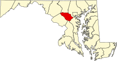
This is a locator map showing Howard County in Maryland. For more information, see Commons:United States county locator maps.
The flag of Howard County, Maryland, originally designed by Jean O. Hannon in 1968. The flag is in the public domain, and the SVG is hereby released into the public domain as well.
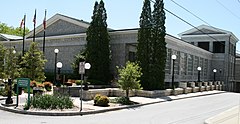
Howard Co. courthouse
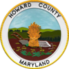
The seal of Howard County, Maryland. The Howard County Seal was designed and approved on behalf of the Howard District of Anne Arundel County in 1840, but the County was not officially established until Howard District was separated from Anne Arundel County in 1851. The seal was designed by Edward Stabler, one of the foremost seal designers of the time (He also designed seals for Anne Arundel County).
The Howard County Code of 1977 stipulates that the seal of the county shall be a copy of the seal designed by Edward Stabler in 1840. The seal depicts "a shock of wheat, centrally dominant, with a hand plow to the left, and a spike harrow to the right. All three (3) are centered on a plowed field with tobacco plants growing in the foreground. Trees and rolling hills form the background, and a cloudless sky forms the upper third of the design."
The County Code describes the colors that are to be used when the seal is rendered in color. The sky--Prussian blue-med.; the wheat--yellow ochre; the hills--graduated shades of teraverte; the tobacco plant in the foreground--Chrome green-med.; the trees--a dark shade of chrome green; the soil--burnt umber-med;.; the spike harrow and the plow blade--Ivory black diluted to gray; and the plow handles--Burnt sienna-med.


