Hrabstwo Nillumbik
| Państwo | |
|---|---|
| Stan | |
| Burmistrz | Warwick Leeson |
| Powierzchnia | 435 km² |
| Populacja • liczba ludności |
|
 | |
| Strona internetowa | |
| Portal | |
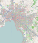
Hrabstwo Nillumbik– obszar samorządu lokalnego (ang. local government area), położony w północnej części aglomeracji Melbourne. Powstała w 1994 roku z połączenia części hrabstw: Eltham, Diamond Valley i Healesville oraz Whittlesea. Obszar ten zamieszkuje 59 792 osób (dane z 2006).
Dzielnice
- Christmas Hills
- Cottles Bridge
- Diamond Creek
- Eltham
- Eltham North
- Hurstbridge
- Kangaroo Ground
- Nutfield
- Panton Hill
- Plenty
- Research
- Smiths Gully
- Saint Andrews
- North Warrandyte
- Watsons Creek
- Wattle Glen
- Yarrambat
Zobacz też
Media użyte na tej stronie
State flag and government ensign (internal waters only) of Victoria.
Autor: Squiresy92 including elements from Sodacan, Licencja: CC BY-SA 4.0
The Coat of Arms of Victoria.
Map of Melbourne, Victoria (Australia), LGA of Nillumbik Shire highlighted
Autor:
Autor: NordNordWest, Licencja: CC BY-SA 3.0 de
Location map of Victoria, Australia


