Hrabstwo Prince George’s
| hrabstwo | |||||
 | |||||
| Państwo | |||||
|---|---|---|---|---|---|
| Stan | |||||
| Siedziba | |||||
| Kod statystyczny | FIPS 6-4: 24033 | ||||
| Powierzchnia | 1 290,98 km² | ||||
| Populacja (2000) • liczba ludności |
| ||||
| • gęstość | 637,5 os./km² | ||||
| Strefa czasowa | UTC -5:00/-4:00 | ||||
Położenie na mapie Maryland | |||||
| Strona internetowa | |||||
| Portal | |||||
Hrabstwo Prince George’s (ang. Prince George’s County) to hrabstwo w amerykańskim stanie Maryland. Hrabstwo zajmuje powierzchnię całkowitą 1 290,98 km² i według szacunków US Census Bureau w roku 2006 liczyło 841 315 mieszkańców. Siedzibą hrabstwa jest miejscowość Upper Marlboro.
Historia
Hrabstwo Prince George’s zostało utworzone w roku 1695 z części hrabstw Calvert i Charles. Nazwa hrabstwa, która po polsku oznacza „hrabstwo księcia Jerzego”, pochodzi od księcia Danii Jerzego Duńskiego, który był bratem króla Danii Chrystiana V oraz mężem Anny Stuart, królowej Anglii. W 1748 roku hrabstwo Prince George’s uległo zmniejszeniu, gdy z jego części i części hrabstwa Baltimore utworzono hrabstwo Frederick.
Geografia
Powierzchnia całkowita hrabstwa Prince George’s wynosi 1 290,98 km², z czego 1 257,26 km² stanowi powierzchnia lądowa a 33,70 km² (2,6%) powierzchnia wodna. Najwyższy punkt w hrabstwie ma wysokość 134 m n.p.m., zaś najniższy punkt położony jest na poziomie morza.
Miasta
- Bowie
- Berwyn Heights
- Bladensburg
- Brentwood
- Capitol Heights
- Cheverly
- Colmar Manor
- Cottage City
- College Park
- District Heights
- Eagle Harbor
- Edmonston
- Fairmount Heights
- Forest Heights
- Glenarden
- Greenbelt
- Hyattsville
- Laurel
- Landover Hills
- Morningside
- Mount Rainier
- New Carrollton
- North Brentwood
- Riverdale Park
- Seat Pleasant
- University Park
- Upper Marlboro
CDP
- Accokeek
- Adelphi
- Aquasco
- Baden
- Beltsville
- Brandywine
- Brock Hall
- Calverton
- Camp Springs
- Cedarville
- Chillum
- Clinton
- Coral Hills
- Croom
- East Riverdale
- Fairwood
- Forestville
- Fort Washington
- Friendly
- Glassmanor
- Glenn Dale
- Hillcrest Heights
- Kettering
- Konterra
- Lake Arbor
- Landover
- Langley Park
- Lanham
- Largo
- Marlboro Meadows
- Marlboro Village
- Marlow Heights
- Marlton
- Melwood
- Mitchellville
- National Harbor
- Oxon Hill
- Peppermill Village
- Queen Anne
- Queenland
- Rosaryville
- Seabrook
- Silver Hill
- South Laurel
- Springdale
- Suitland
- Summerfield
- Temple Hills
- Walker Mill
- West Laurel
- Westphalia
- Woodlawn
- Woodmore
Demografia
Według szacunków US Census Bureau w roku 2006 hrabstwo Prince George’s liczyło 841 315 mieszkańców.
Współpraca
 Royal Bafokeng Nation, Południowa Afryka
 Riszon le-Cijjon, Izrael
 Ziguinchor, Senegal
Bibliografia
- Podstawowe dane statystyczne o hrabstwie Prince George's US Census Bureau (en)
- Podstawowe dane statystyczne dotyczące hrabstw w stanie Maryland US Census Bureau (en)
- Najniżej i najwyżej położone punkty w hrabstwach w Maryland. mgs.md.gov. [zarchiwizowane z tego adresu (2014-01-03)]. Maryland Geological Survey (en)
- Profil hrabstwa Prince George's Maryland State Archives (en)
Media użyte na tej stronie
The flag of Navassa Island is simply the United States flag. It does not have a "local" flag or "unofficial" flag; it is an uninhabited island. The version with a profile view was based on Flags of the World and as a fictional design has no status warranting a place on any Wiki. It was made up by a random person with no connection to the island, it has never flown on the island, and it has never received any sort of recognition or validation by any authority. The person quoted on that page has no authority to bestow a flag, "unofficial" or otherwise, on the island.
Flag of Israel. Shows a Magen David (“Shield of David”) between two stripes. The Shield of David is a traditional Jewish symbol. The stripes symbolize a Jewish prayer shawl (tallit).
Flag of Senegal
This is a locator map showing Prince George's County in Maryland.
David Benbennick made this map. For more information, see Commons:United States county locator maps.The flag of Prince George's County, Maryland, as officially defined in the county code. What differentiates it from many currently-used flags is that it uses the 1958 to 1971 county seal in the top left-hand corner instead of the current post-1971 seal. Although it is not as widely used, according to the county code, as of 2018, this is still technically the official flag of the county: "Sec. 1-106. County flag; contents. The official County flag shall be a three (3) feet by five (5) feet flag of white, divided in equal quadrants by four (4) inch stripes of red and containing in its upper left quadrant the official seal of the County as adopted by the Board of Commissioners on November 25, 1958. (Ord. and Res. 1967, Sec. 1-6)". However, in practice, most, if not all, of the flags manufactured and currently used by the county disregard the county code's description of the flag and instead feature the post-1971 seal in the top left-hand corner. More information about the flag and seal can be found here, here, here, and here.
Autor: Sharosh Rajasekher sharosh, Licencja: CC0
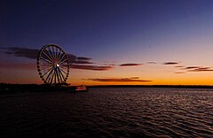
National Harbor, Fort Washington, United States
Coat of arms of Prince George's County, Maryland.
Autor: Autor nie został podany w rozpoznawalny automatycznie sposób. Założono, że to WarXboT (w oparciu o szablon praw autorskich)., Licencja: CC BY-SA 2.5
Piramida wieku dla hrabstwa Prince George's w stanie Maryland w USA na podstawie spisu ludności z 2000 roku


