Hrabstwo Westchester
| ||||
| ||||
 | ||||
| Państwo | ||||
|---|---|---|---|---|
| Stan | ||||
| Siedziba | White Plains | |||
| Powierzchnia | 1295 km² | |||
| Populacja (2000) • liczba ludności | 923 459 | |||
| • gęstość | 824 os./km² | |||
Położenie na mapie Nowy Jork | ||||
| Strona internetowa | ||||
| Portal | ||||
Westchester – hrabstwo (ang. county) w stanie Nowy Jork w USA. Populacja wynosi 923 459 mieszkańców (stan według spisu z 2000 r.).
Powierzchnia hrabstwa wynosi 1295 km². Gęstość zaludnienia wynosi 824 osób/km².
Miasta
- Bedford
- Cortlandt
- Eastchester
- Greenburgh
- Harrison
- Lewisboro
- Mamaroneck
- Mount Kisco
- Mount Pleasant
- Mount Vernon
- New Castle
- New Rochelle
- North Castle
- North Salem
- Ossining
- Pelham
- Peekskill
- Pound Ridge
- Rye
- Scarsdale
- Somers
- Yorktown
- Yonkers
- White Plains
Wioski
- Ardsley
- Briarcliff Manor
- Bronxville
- Buchanan
- Croton-on-Hudson
- Dobbs Ferry
- Elmsford
- Hastings-on-Hudson
- Irvington
- Larchmont
- Mamaroneck
- Ossining
- Pelham
- Pelham Manor
- Pleasantville
- Port Chester
- Rye Brook
- Sleepy Hollow
- Tarrytown
- Tuckahoe
CDP
- Armonk
- Bedford
- Bedford Hills
- Crugers
- Chappaqua
- Crompond
- Eastchester
- Fairview
- Greenville
- Golden's Bridge
- Hawthorne
- Hartsdale
- Heritage Hills
- Jefferson Valley
- Katonah
- Lake Mohegan
- Lincolndale
- Montrose
- Shrub Oak
- Shenorock
- Scotts Corners
- Thornwood
- Yorktown Heights
- Verplanck
- Valhalla
Linki zewnętrzne
Media użyte na tej stronie
The flag of Navassa Island is simply the United States flag. It does not have a "local" flag or "unofficial" flag; it is an uninhabited island. The version with a profile view was based on Flags of the World and as a fictional design has no status warranting a place on any Wiki. It was made up by a random person with no connection to the island, it has never flown on the island, and it has never received any sort of recognition or validation by any authority. The person quoted on that page has no authority to bestow a flag, "unofficial" or otherwise, on the island.
This is a locator map showing Westchester County in New York. For more information, see Commons:United States county locator maps.
Autor:
- real name: Artur Jan Fijałkowski
- pl.wiki: WarX
- commons: WarX
- mail: [1]
- jabber: WarX@jabber.org
- irc: [2]
- software: own perl scripts
Piramida wieku dla hrabstwa Westchester w stanie Nowy Jork w USA na podstawie spisu ludności z 2000 roku
Autor: Various, see individual links., Licencja: CC BY-SA 4.0
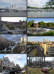
Compilation of Westchester images.
- File:Scarsdale lunch park jeh.jpg
- File:137-3778 IMG (14938233).jpg
- File:Downtown Katonah, NY.jpg
- File:Daylighted Saw Mill River Downtown Yonkers.jpg
- File:Daylighted Saw Mill River Downtown Yonkers.jpg
- File:New Croton Dam NY1.jpg
- File:New Tappan Zee bridge 2018 Aug a jeh.jpg
- File:View of Philipsburg Manor (Sleepy Hollow) New York.jpg


