Hrdlořezy
| ||||
| ||||
 | ||||
| Państwo | ||||
| Miasto | Praga | |||
| Data założenia | 1922 | |||
| Powierzchnia | 1,96 km² | |||
| Populacja (2006) • liczba ludności | 495 | |||
| • gęstość | 253 os./km² | |||
| Kod pocztowy | 102 00 | |||
| Portal | ||||
Hrdlořezy – dzielnica Pragi. W 2006 zamieszkiwało ją 495 mieszkańców.
Media użyte na tej stronie
Prague location map.png
Autor:
Map of Prague, Czech Republic
Autor:
OpenStreetMap contributors
,
Licencja: CC BY-SA 2.0
Map of Prague, Czech Republic
Praha CoA CZ.svg
Prague coat of arms.
Prague coat of arms.
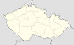
Czech Republic location map.svg
Autor: Lencer, Licencja: CC BY-SA 3.0
Location map of the Czech Republic
Autor: Lencer, Licencja: CC BY-SA 3.0
Location map of the Czech Republic
Tram loop, Prague Hrdlořezy.jpg
Autor: Czech Wikipedia user Packa, Licencja: CC BY-SA 2.5
Tram loop and Constructional secondary school at local part Jarov at Hrdlořezy, Prague
Autor: Czech Wikipedia user Packa, Licencja: CC BY-SA 2.5
Tram loop and Constructional secondary school at local part Jarov at Hrdlořezy, Prague


