Huittinen
 | |||
| |||
| Państwo | |||
|---|---|---|---|
| Region | |||
| Powierzchnia | 539,59 km² | ||
| Populacja (31.12.2021) • liczba ludności |
| ||
| Kod pocztowy | 32700 | ||
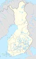
Położenie na mapie Finlandii (c) Karte: NordNordWest, Lizenz: Creative Commons by-sa-3.0 de | |||
| Strona internetowa | |||
| Portal | |||
Huittinen – gmina w Finlandii, położona w południowo-zachodniej części kraju, należąca do regionu Satakunta.
Przypisy
- ↑ Väestö 31.12. muuttujina Alue, Ikä, Sukupuoli, Vuosi ja Tiedot, Tilastokeskus [dostęp 2022-10-18] [zarchiwizowane z adresu 2022-10-18] (fiń.).
Media użyte na tej stronie
Finland adm location map.svg
(c) Karte: NordNordWest, Lizenz: Creative Commons by-sa-3.0 de
Location map of Finland
(c) Karte: NordNordWest, Lizenz: Creative Commons by-sa-3.0 de
Location map of Finland
Flag of Finland.svg
Flaga Finlandii
Flaga Finlandii
Huittisten.vaakuna.svg
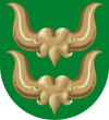
Coat of arms of Huittinen
Coat of arms of Huittinen
Huittinen church Aug2008.jpg
The church in Lauttakylä, Huittinen, Finland. The oldest part of the building was probably built in around 1495.
The church in Lauttakylä, Huittinen, Finland. The oldest part of the building was probably built in around 1495.


