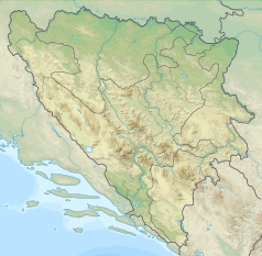
Igman
Igman/Crni Vrh, widoczne skocznie olimpijskie | |
| Państwo | |
|---|---|
| Położenie | |
| Pasmo | |
| Wysokość | 1506 m n.p.m. |
Igman – masyw górski w Górach Dynarskich. Leży w Bośni i Hercegowinie. Jego najwyższy szczyt Crni Vrh osiąga wysokość 1506 m.
Linki zewnętrzne
- Igman. skijanje.rs. [zarchiwizowane z tego adresu (2010-02-12)].
Media użyte na tej stronie
U+25B2.svg
Black up-pointing triangle ▲, U+25B2 from Unicode-Block Geometric Shapes (25A0–25FF)
Black up-pointing triangle ▲, U+25B2 from Unicode-Block Geometric Shapes (25A0–25FF)
Igman.jpg
(c) Xe0us z angielskojęzycznej Wikipedii, CC-BY-SA-3.0
Mont Igman / Mount Igman, with the Igman Olympic Jumps that were used during the Winter Olympics in 1984
no original description
(c) Xe0us z angielskojęzycznej Wikipedii, CC-BY-SA-3.0
Mont Igman / Mount Igman, with the Igman Olympic Jumps that were used during the Winter Olympics in 1984
no original description
Relief Map of Bosnia and Herzegovina.svg
Autor:
Relief Map of Bosnia and Herzegovina
Autor:
- Dinaric_Alps_map-es.svg: *Dinaric_Alps_map-fr.svg: Sémhur
- derivative work: GabrielZafra (talk)
- derivative work: BokicaK (talk)
- derivative work: Ivan25 (talk)
Relief Map of Bosnia and Herzegovina
- Cropped and edited original file with Inkscape.


