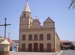
Iguatu (Ceará)
(c) Witxel, CC BY 3.0 | |||||
| |||||
| Państwo | |||||
|---|---|---|---|---|---|
| Stan | |||||
| Populacja • liczba ludności |
| ||||
| Nr kierunkowy | 88 | ||||
| Kod pocztowy | 63.500-000 a 63.509-999 | ||||
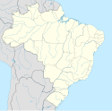
| 6°21′32″S 39°17′56″W/-6,358889 -39,298889 | |||||
| Strona internetowa | |||||
Iguatu – miasto w Brazylii, w stanie Ceará. W 2010 roku liczyło 74 627 mieszkańców. Siedziba diecezji.
Media użyte na tej stronie
Flag of Iguatu, CE.
Flag of the State of Ceará, Brazil
Coat of arms of Iguatu, CE.
Autor:
- Ceara_MesoMicroMunicip.svg: Raphael Lorenzeto de Abreu
- derivative work: Milenioscuro (talk)
Location map of Ceará state. Geographic limits of the map:
- N: 2.61° S
- S: 7.95° S
- W: 41.6° W
- E: 37.14° W


